TRIP REPORT PHOTOS
The parking area to begin the hike is about 3 miles south on Racetrack Road coming from the Ubehebe Crater area:

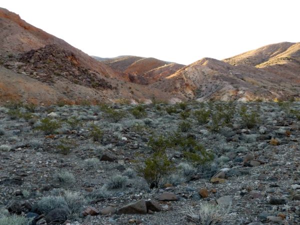
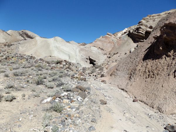
We did not head for the main canyon wash slightly to the south, but rather approached this smaller side canyon:
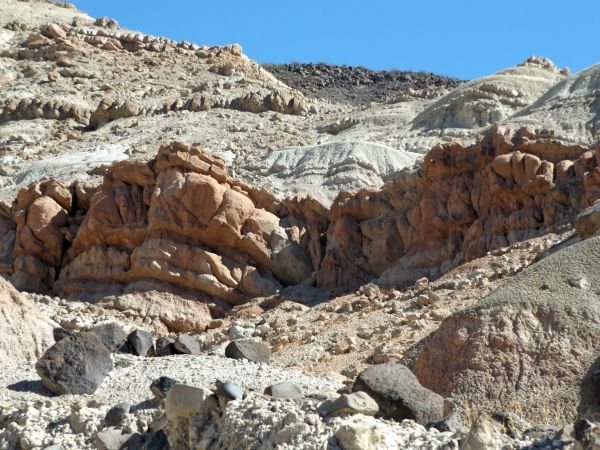
Right near the canyon mouth, an abundance of colors were already visible:

Seeing so many colors on the walls was a great way to start what I had been calling the "Ubehebe Colors Loop" informally during route planning:

This bend in the canyon revealed even more vivid colors:

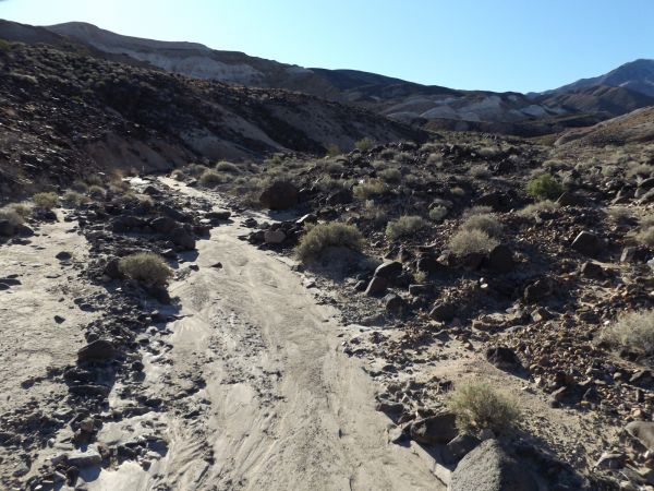
We were hiking through a generally wide and shallow canyon. But there were tighter spots like this:

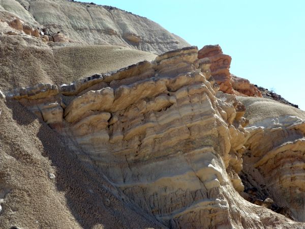
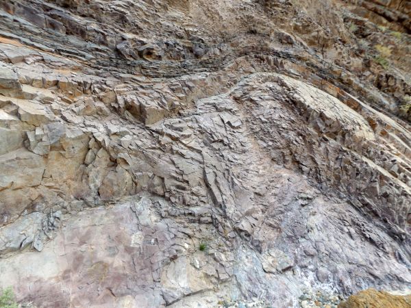
It is amazing how so many different colors can be found on the same canyon wall. I did a color check on this picture, and the four most prominent colors seen are named Emperor (purple), Nutmeg (red), Muddy Waters (gold), and Russet (dark brown):

Notice the composition of the walls through here, almost like sections of blocks:

The bright sunshine was turning these red rock walls into a golden yellow:

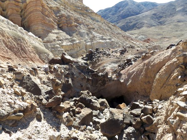
The first of many dry falls that we would encounter during the day:

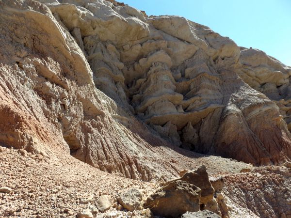
After emerging from the short colorful canyon, we turned off to the right here and headed toward the white foothills:
As we approached the base of the hills, we could see they were made up of mud with color bands:

A mixture of the mud ground with solid rock tinged with the color pink:

This wall reminded me a little bit of the tafoni in Tafoni Canyon in the Saline Range:

The wash we were in came to an abrupt end at this dry fall:

Several times we crossed over from one wash to the next, as the goal was to stay at the base of the white hillsides:

Looking up the hillsides, it was interesting to see how they would change rock type and color up above:

The sun really brightened these tall outcroppings of white rock:

The darker small rocks really stood out on the light-colored soft terrain:
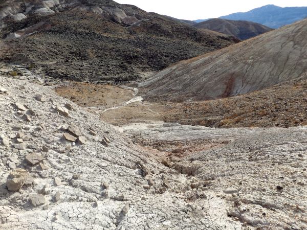
Reaching a vantage point where we could see how the main canyon entered into this area:

The white hillsides through here rose up like something out of a fairy tale:

This is the spot where we descended the white hillsides and dropped into the main wash for a short distance:

The rugged slopes of Tin Mountain were covered by a fresh blanket of snow from the night before in mid-March:

Even the hillsides above the main wash were filled with so much variety:

We soon turned left and then right into a couple of side canyons. There were a maze of side canyons and options through this area:

These were interesting narrows because the diagonal slopes look different from a normal canyon:

Encountering another dry fall that presented a challenge to us:

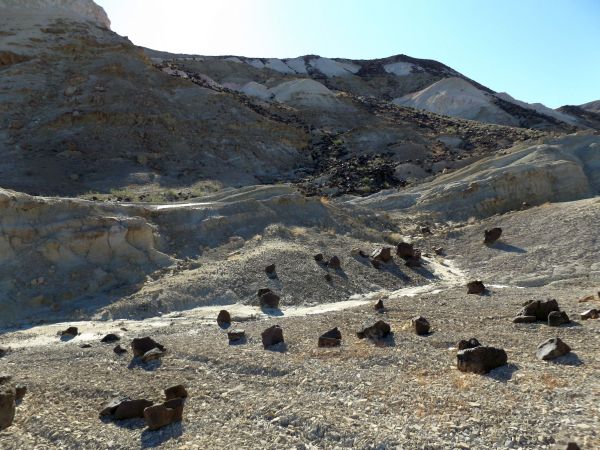
We circled around into a large basin which had these uplifted, rounded white rock outcroppings:

Notice how the different rock types all have the same structure, although the lower outcropping have begun crumbling away:

The white rounded rock extended like waves across the hillside:
Looking across at the Last Chance Range, Marble BM is visible at the right center (directly above my shadow):

This is the basin we had climbed up into with various wash forks:

One more look at the unique rounded rock formations which make this hillside special:

Panoramic showing the basin and surrounding hillsides with rounded rock outcroppings (click to enlarge):

Had we wanted to hike directly to the saddle leading to the mud bridges, we could have hiked in the wash far below and made things easier:

Looking up toward the slopes of Tin Mountain, you can see that a summit approach from the north would be quite challenging:

The red arrow shows the actual summit of Tin Mountain (8,953 feet):

We needed to get down to the saddle seen below us here. As you can see, it would be a fairly challenging descent:

This area below the saddle looked like it would be quite interesting to explore:

We began noticing tunnels through the mud terrain for water flow:

I'm not sure of the technical term for this type of terrain, but it was like soft dry mud:

Notice that the actual wash enters into a tunnel as it flows beneath the mud hillside:

Up ahead, the wash passed through a larger mud bridge (or tunnel):
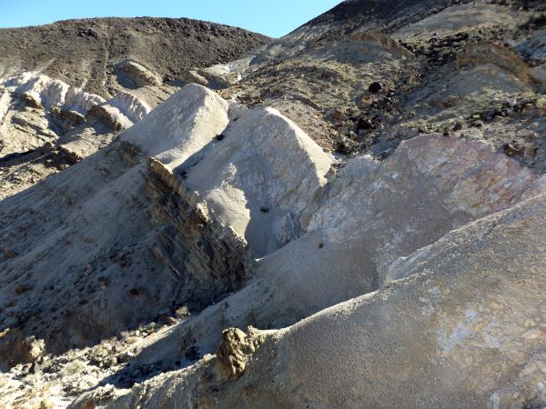
The hillside above us became covered by fantastic formations of eroded rock:

Taking a closer look, notice how the sections of rock extend out farther the higher up it goes:

Some of the mud bridges (or tunnels) like this one were easy to climb around, while others were harder:

An incredible display of beauty on the hillside above us:

These natural rock sculptures had a reddish tint and resembled stacked flat rocks:

Notice how the rock sculptures extended a fair distance along the hillside:

It seemed like everywhere we looked, there was something new and interesting to see:

Quite an unusual canyon wall shaped by erosion and natural forces:

Mike standing in front of one of the mud bridges as they became larger in size:

There were various shades of red and blue-green on this hillside:

The next two pictures show additional views of the incredible hillside formations:

This could be a side drainage. If water did flow down this area when it rained, it would make for a beautiful series of small waterfalls:

Encountering a series of smaller mud bridges across the wash in the next three pictures:

We had to take care when climbing around some of these that we didn't crush them and cause them to collapse:

One of the easier mud bridge spots to climb around:

A mud bridge with a top part that is higher than me:

The red layer of rocks adds a nice contrast to the white and black all around:
The mud layer of soil appears to erode much faster than the solid rocks, thus leaving outcroppings extending way out of the hillside:

It's amazing how much beautiful rock is hidden beneath the mud soil:
The last mud natural bridge that we encountered was the largest:

The bottom surface of this large natural bridge isn't just mud. Solid rock that is jagged in appearance is visible:

Mike bypassing the large mud natural bridge, even though it is possible to easily walk through this one:

The rock type on the hillside above the bridge looks the same, but it is made of two completely different colors:

This is the backside of the large natural bridge that we had bypassed:

Notice how thick the mud bridge is as it completely blocks the canyon with the exception of the water tunnel in the middle:

A view looking back at the large mud bridge from a little farther down canyon:
The next three pictures showcase some of the colorful hillsides as we continued down canyon:


Rather than continuing all the way to the next canyon junction, we turned off early to attain the ridge. These conglomerate rock columns greeted us in the side canyon we chose:

There was a maze of side canyons to choose from heading toward the ridge. We finally picked one and began hiking up the difficult terrain:

To reach the ridge, we had to use bypasses, climb steep terrain, and adjust the route several times:

We finally made it and looked back toward the canyon junction we would have encountered had we not used this shortcut. We had saved some distance, but not saved any time due to the rough climb:

The view of Grapevine Peak (8,738 feet) across the valley looked incredible with a fresh coat of snow on the summit:

A unique angle of cone-shaped Wahguyhe Peak (8,628 feet) could also be seen:

Mount Palmer (7,958 feet) could be seen to the east (bump at left center):

Three major peaks of the Grapevine Mountains are all visible here. Can you spot Grapevine Peak, Wahguyhe Peak, and Mount Palmer?:

After dropping into the canyon and finding multiple tough dry falls, we hiked back up to the ridge. As you can see, the terrain ahead was much easier to handle:

A nice flat section on the ridge to enjoy after a very challenging day so far:

Looking to the northwest, a saddle was visible which we had to reach as our next objective in the loop hike:

Reaching the dry lake bed just below the peak labeled as 4120T on the topo map:

The small dry lake bed was an unexpected find on a day of several interesting discoveries:

Earlier, we had reached the saddle dividing the two canyons to the south. Now, we were trying to reach the saddle dividing the two canyons on the north side:

Looking down into the hills labeled on our included map as "colorful cliffs area #2":

As we approached the wash, it looked like the Ubehebe Colors Loop was going to deliver another outstanding area to explore:

Finding a mixture of purple rock and green rock side by side:

Check out the erosion happening on this hillside. It looks like entire large areas could collapse at once:

We ran into more impassable dry falls, so we had to exit the wash and climb back onto the ridge:

Such a pretty band of white rock encircling the area:

Looking up at the white band of rock along with all the other layers making up the hillside:

Panoramic showcasing the impressive hillside with a white band of rock (click to enlarge):

Making our way back down to the wash once again. We spent a lot of time searching out and doing bypasses on this day:

Looking back up canyon as the impressive band of white rock towers above us:

My second lifetime hike in the park with Mike. The first was to Sunlight Bridge a few months earlier:

Notice how the mud takes on shades of pink and yellow:

After reaching a minor canyon junction, we climbed up and around in an effort to reach a more major canyon that was a little bit to the north:
Heading down our final canyon of the day which would allow us to complete the epic loop hike:

True to the informal name of this hike (Ubehebe Colors Loop), this canyon also had an abundance of colors:

Passing by a vivid purple and pink canyon wall:

Shades of yellow and green mixed in with the purple rock:

This proved to be the most interesting canyon we hiked through on the day and would make a worthy goal for a half-day hike on its own:

The walls of the canyon began to resemble stacks of flat rocks:

Notice how the composition is the same on both sides of the canyon:

The flat rocks take on the appearance of rock shelves extending way up high:

Two more pictures showing the stacks of flat rocks which make this canyon unique:


Such a beautiful canyon wall with various shades of color and distinct curved lines:
This was the only significant dry fall within the canyon, at about the halfway point. It was somewhat challenging to climb down:

Looking back at the dry fall, we did find some footholds but it took some trial and error to get down:


A neat pour-off in the canyon in between some narrow walls:
Pink, green, purple, and orange were all visible on the hillside above the canyon:

Even after exiting the canyon narrows, the hillsides were still very unique and interesting:

Strange shapes with an abundance of colors:

The Ubehebe Colors Loop ended with yet another pretty hillside:

The final three pictures were taken near the mouth of the canyon where we came across a cactus garden: