TRIP REPORT PHOTOS
This is the rough spot in the road just past the informal campground on Phinney Canyon Rd. It is actually worse than it looks in this photo:

Still on Phinney Canyon Rd, here the headwall beneath the 1st major bump on the hike can be seen up high:

Upon reaching the Phinney-Moonlight saddle, a closed portion of the road continues down the other side into upper Moonlight Canyon:

Zooming in on Grapevine Peak, which is first visible when standing at the saddle:

The hike begins by climbing north from the saddle up the slope seen here:

Looking back down on the saddle after climbing a short distance:

Grapevine Peak would appear from different vantage points along the route. It's nice to have a hike where you can frequently see the end point:

The next two pictures show some of the small rock crags in between the saddle and 1st major bump. It would have been easier to stay on the right side of these rather than hiking directly over them:


A view back into upper Moonlight Canyon, which is a hike that Tobin and I had done 6 1/2 years earlier:

The entire ridge of Wahguyhe Peak became visible. This was the hike that we had done the day before:

Zooming in on the distinctive cone-shaped summit block of Wahguyhe Peak:

Staying on the right side of some more rock outcroppings. Up ahead, the 1st major bump can be seen:

The hike has faint use trails which appear every so often. Here, we have found an use trail heading through the trees:

We followed the use trail along the left side slope of the 1st major bump, thus avoiding hiking up to the actual bump:

The route opens up a little bit at times allowing for better visibility and easier navigating:

Looking across at three prominent peaks which rise up above Moonlight Canyon:

Rounding the bend beneath the 1st major bump and looking back at the progress we have made:

The 2nd major bump is not far from the 1st. However, this is a tricky area up ahead:

Our first view of Coyote BM (high point on right) during the hike:

Coyote BM's named peak is on the right side, but the left side peak is actually 2 feet higher in elevation:

Navigating through a thick section of trees while climbing up the slopes of the 2nd major bump:

Looking back, you can see the 1st major bump along with the ridgeline which heads down to the right toward the saddle:

View to the northeast. The small peak visible on the right side which is at the foot of the Grapevine Mountains is called Vine BM:

The entire northern Mount Palmer ridgeline became visible. When hiking to the summit of Mount Palmer, this all must be hiked along after crossing the head of Red Wall Canyon:

Zooming in on the summit block of Mount Palmer, where I had been standing 3 years earlier:

The view of Grapevine Peak was magnificent from the top of the 2nd major bump:

I was continuously looking for alternate angles of Coyote BM, since that is a hike I have planned for the near future:

The forested slopes surrounding Wahguyhe Peak are quite a contrast with the bare cone made of loose scree which makes the summit so easy to identify:

After taking a wrong turn, we hiked back to the 2nd major bump and got back on the correct ridgeline. This was the terrain looking ahead:

After dropping down to a flat area, we could see some large rock crags ahead. It is best to hike through the forest on the left side to avoid them:

I think this picture was taken looking back. At the bottom, you can see the flat area. At the top, you can see the 2nd major bump on the left and the wrong bump on the right:

There was a deep valley below us to the north which separated our ridge from the ridge leading to Coyote BM:

Working my way around some large rock crags on the right side. On the hike back, I realized that the terrain was a lot easier on the opposite side:

Vine BM (6,380 feet) was once again visible at the bottom right of this picture. Vine BM is a rarely-hiked minor peak located in the Nevada Triangle:

A minor bump is visible in the distance while hiking up toward the 3rd major bump:

A nice view of Mount Pamer, which pops up above a distant ridgeline once again:

A Pricklypear cactus growing between the rocks. According to the NPS, Grizzly bear pricklypear is the most common cactus species found in the pinyon-juniper woodlands:

Tobin can be seen here taking a break on a rock outcropping near the top of a minor bump:

The valley leading down toward Vine BM is quite wide and spacious:

Looking back toward the 1st major bump and 2nd major bump. On the right side, you can see the wrong bump which hikers like us might accidentally hike up to:

We are now standing on the 3rd major bump. In the next section, the key is to stay to the left of the visible rock crags:

If this next section is not hiked correctly, it will be a lot more challenging to reach the 4th major bump:

As is usual between major and minor bumps, there are downhill portions where you lose elevation:

On another flat area with several large rock crags ahead:

The summit remains visible which helps you track your progress throughout the hike:

Here, I think we are looking toward the 4th major bump after navigating through another forest section:

A faint use path leads the way around the right side beneath the 4th major bump:

Below us, we could see a fairly large flat area which we were now hiking down to:

Lots of pinecones visible on this tree up ahead:

Zooming in on some of the many pinecones, which seemed to grow in abundance near the top of the tree:

This flat area marks the beginning of what is known as the final 800-foot climb. From this spot, it is simply an 800-foot elevation climb to the summit with no more bumps:

This loose scree field (which bears some similarity to what is found on the slops of Wahguyhe Peak) can be avoided by hiking on the left side of it:

Looking back down the optional scree field toward the 4th major bump behind us:

Picking up another use trail through the forest:

The mountain slopes near the summit have some fairly tall trees:

The second scree field during this section is not optional. It must be climbed up:

Just above the second scree field, the mountain opens up wide with good visibility all around:

The sections of ridgeline we hiked along earlier look quite distant now:

The terrain along the bare summit section is very good for hiking on:

Sulphur Buckwheat was in bloom above 8,000 feet in elevation:

Sulphur Buckwheat flowers usually start out being bright yellow in color before turning red later in the season:

Granite Gilia (also known as Mountain Prickly Phlox) was in bloom nearby the Sulphur Buckwheat:

One more close-up picture of the colorful Sulphur Buckwheat. Notice that traces of red are starting to show on these flowers:

Tobin found a perfect natural bench in route to the summit:

More bare terrain before heading back into the forest up ahead:

Looking down the bare slopes toward the distant horizon to the east:

It's interesting how you enter one final section of forest before reaching the summit:

Quite a wide variety of trees on display with some being large, some small, and some bare (or perhaps even dead):

Additional scree scattered across the ground as we approached the top, as seen in the next two photos:


This is the repeater box at the summit which has been painted with camouflage paint to blend in with the surroundings:


The repeater antenna helps NPS staff to keep in touch throughout the park:
This is the actual summit of Grapevine Peak (8,738 feet):

We started with the summit register book. Well-known DV hiker Kauri hiked this peak on April 14, 2014 and enjoyed having no wind at the top. We were not so fortunate on our hike:

Former DV Wilderness Coordinator Charlie came up here once with a work crew to clean up the summit. Charlie spent a lot of time cleaning up park summits to make them more clean and enjoyable for all future hikers:

Almost exactly two years ago, current DVNP Superintendent Mike Reynolds visited the summit:

NPS staff members Tom and Sarah hiked to the summit in early August of last year:

It looks like the repeater replacement was done last year in September by helicopter:

Tobin and I made our entries in the register book at the summit:

Our views from the summit start to the east with the silhouette of Springdale Mountain (4,941 feet) visible on the left and Donovan Mountain (5,547 feet) visible on the right at the edge of Sarcobatus Flat about 20 air miles away:

To the southeast, the ridgeline of Wahguyhe Peak stands out:

Zooming in on the cone-shaped summit of Wahguyhe Peak:

Also looking to the southeast down an extensive section of the Grapevine Mountains:

As viewed from Grapevine Peak, Corkscrew Peak (left) and Thimble Peak (right) appear side-by-side:

A closer view of the two majestic summits of Corkscrew Peak (5,804 feet) and Thimble Peak (6,381 feet):

Due south of the summit stands impressive Mount Palmer:

Mount Palmer (7,958 feet) is the second most challenging major peak hike in the park (after Dry Mountain):

The four small peaks seen along this ridge tower above Moonlight Canyon:

The minor peak seen here is found along the western Grapevine Peak ridgeline and divides Moonlight Canyon and Backthrust Canyon:

Visibility from the summit was poor on this day due to fierce winds in the valley, but Backthrust Canyon would be just below the slopes seen here:

The two peaks which can be identified in the northern part of the Grapevine Mountains seen here are 7932T (left) and P8460 (rounded bump in center of picture):

Some of the lower foothills across the way from Grapevine Peak when looking to the northwest. This is actually the head of seldom-visited Backthrust Canyon:

Looking to the north, Coyote BM stands out:

At 8,570 feet in elevation, Coyote BM (right side) is planned as our next major Death Valley summit hike:

The two white spots in the distance are Alkali Flat. Quartzite Mountain (7,766 feet) is the background center peak and is located some 60 air miles away. Black Mountain (7,226 feet) is the peak just to the right of it:

Pictures of myself and Tobin with Wahguyhe Peak in the background:


Tobin pictured with Coyote BM in the background:

Getting a picture with Mount Palmer in the background:

The only remaining Grape benchmark that we could find:

Sulphur Buckwheat was also blooming at the summit:

Notice that this Sulphur Buckwheat plant was beginning to change from yellow to red:

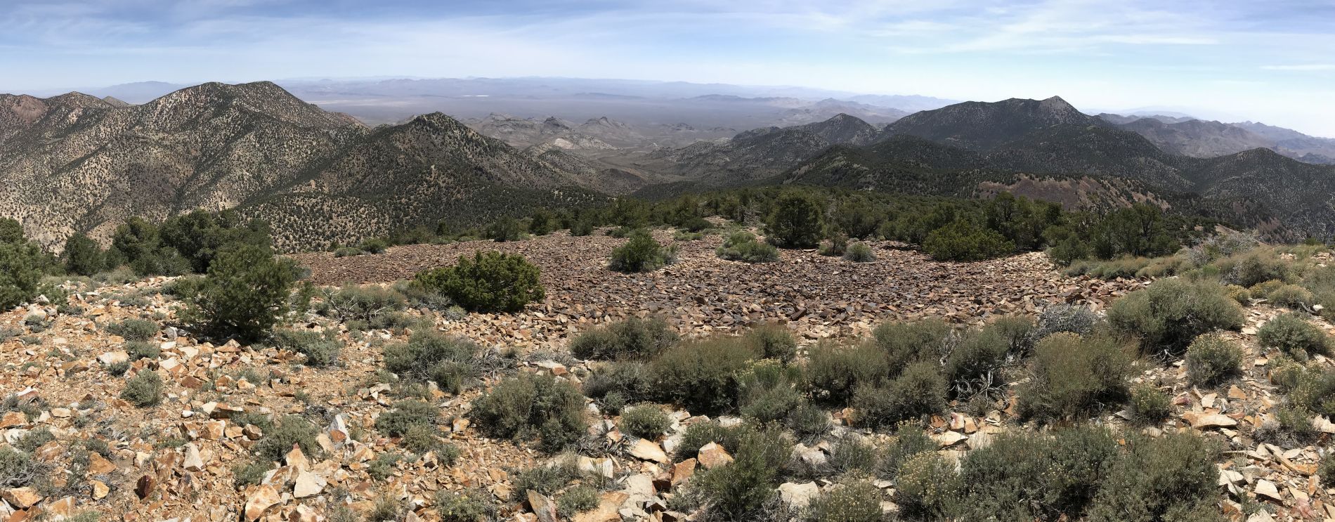
Panoramic from Grapevine Peak showing Coyote BM and Wahguyhe Peak (click to enlarge):
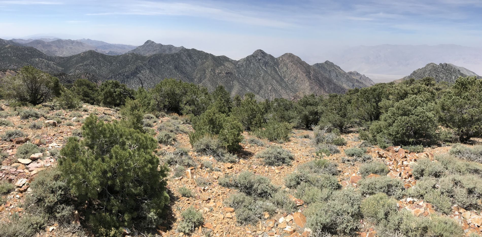
Panoramic from Grapevine Peak featuring Mount Palmer and looking south (click to enlarge):
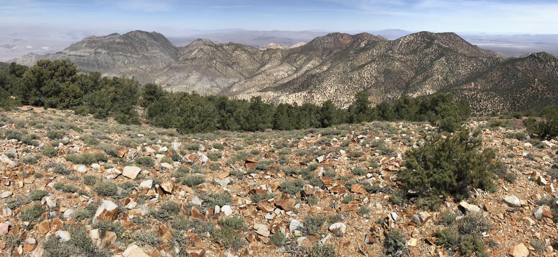
Panoramic from Grapevine Peak looking at the northern Grapevine Mountains (click to enlarge):
During the hike back, we came across a Pricklypear cactus fully in bloom:

Beautiful yellow flowers found on a Pricklypear cactus: