


TRIP REPORT PHOTOS
There isn't a lot of space for passing vehicles at the parking area along the Harry Wade Road:

The hike begins by heading east with McLain BM (left) visible on the background range:

The wash soon becomes entrenched with soft mud walls on each side:

A rock formation rising up from the mud:

A huge overhanging rock which might soon join the others visible by falling down into the wash:

The miniature canyon portion of the hike soon comes to an end:

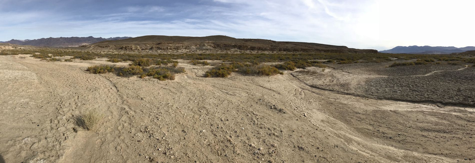
Panoramic of the downstream portion of the Amargosa River where we turned south (click to enlarge):
This wooden marker had been placed in the ground for some unknown reason:

Despite being the end of the long dry season in Death Valley, there was an abundance of water in the Amargosa River:

The river's source is Valley Spring, the beginning of which is 2 miles upstream from this spot:

We soon noticed that the water's surface appeared to have some type of "pond scum" on it anywhere that water was not moving swiftly:

Looking across at the small foothills we had passed through in order to reach the Amargosa River:

While passing through this area, we stayed to the left in order to have a walking route clear of brush:

Tall rocky cliffs rose up on the left side of the riverbank:

A scenic portion of the river with sunlight reflecting off the water:

Apparently, the "pond scum" is algae or cyanobacteria, which can be hazardous to humans and animals but provides a source of food for the pupfish:


The narrow river weaves between grassy areas on the left and the rock walls on the right:
The next two pictures show rock formations above the riverbank:


Dead brush has been stacked up in this location, either from high river flow or non-native species removal:

With the "pond scum" on the surface, this may not be the best source for drinking water in the park:

Cracked mud both above and below the surface of the water:

Looking downstream at the extensive cracked mud patterns visible underwater:

More unique patterns of cracked mud along the riverbank:

Animal tracks were clearly visible in the mud. These are most likely mountain lion or bobcat tracks:

Notice there are no claw marks visible, so these are not coyote tracks. They must be from a mountain lion or bobcat:

The first large pond that we found in the Valley Spring area:

A wider view showing more of the first large pond:

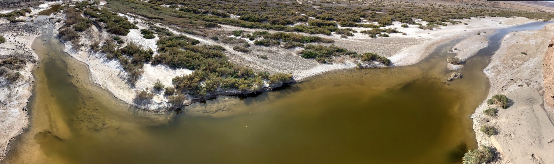
We were able to scramble on top of a mud hillside and get an overview of the first large pond. This shows the upstream end:

The downstream end of the first large pond. Notice that the pond looks fairly deep in the center:

The pond releases water as the Amargosa River flows downstream:

Panoramic showing the first large pond of Valley Spring (click to enlarge):
Looking upstream from our vantage point above the first large pond:

Notice how the river winds close to the walls of the hillside we were standing on. So the only way to continue is to hike along the hilltops:

Panoramic showing the second large pond of Valley Spring (click to enlarge):
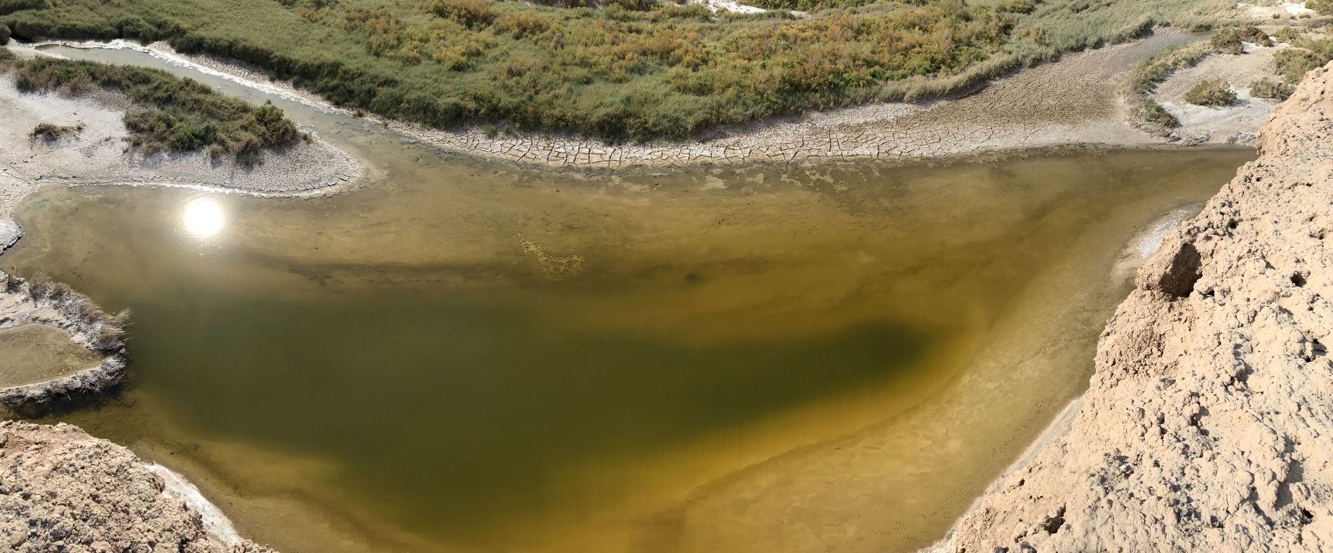
Looking down into the deep portion of the second large pond:

Greenery stretching on for as far as the eye can see. None of this area is visible from the road when driving through the Owlsheads:

Looking down into the third large pond as we continued along the edge of the hillsides:

Panoramic showing the third large pond of Valley Spring (click to enlarge):
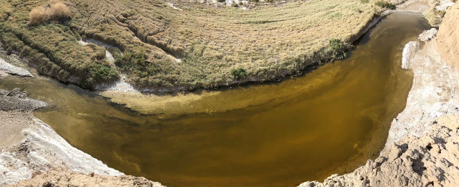
View showing the upstream end of the third large pond:

A shallow channel flows into a deeper channel at this spot:

Several tiny waterfalls were pouring over in this channel:

This pond was covered with a thick layer of cyanobacteria and "pond scum":

I found this small gap in the riverbank which allowed water to flow out of the pond and down a small stream:

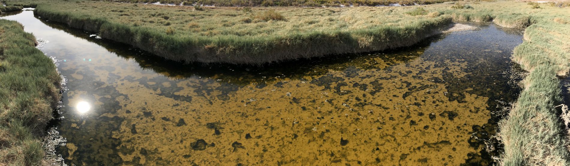
Panoramic of a blue-green cyanobacteria-covered pond (click to enlarge):
Rather than being a circular large pond, some of the ponds had small forks which extended out in several directions:

The first place where we spotted the Amargosa River pupfish. Hundreds of pupfish are visible here:

Zooming in on the pupfish was tricky because they were very skittish and fast swimmers:

The pupfish also blended in well with the bottom of the river:

Many sections of the Amargosa River through this area had water that was very slow moving:

Looking down at a thick layer of "pond scum":

Two close-ups of "pond scum" on the surface of the water. The pupfish might enjoy feeding on this stuff, but we definitely didn't rinse off our hands in it:


Panoramic showing the second major river fork as marked on our map (click to enlarge):
Near this fork, we found many pupfish swimming back and forth between the main river and side stream:

A lone pupfish swimming by and casting a shadow under the water:

We reached the edge of a wide grassy area which extended far into the distance:

Getting a picture at a very scenic area of Valley Spring:

A long, narrow pond (or possibly stream) with heavy greenery on both sides:

It looked like there were some taller grasses out in the middle of the green field:

Two pictures taken in each direction as we crossed the green field. Underneath, there were water channels we had to carefully step over:


A closer look at the taller grasses in the next two pictures:


There were a few larger trees visible as we hiked in between the second river fork and first river fork:

Beyond the first river fork (as marked on our map), we found one more channel filled with surface water:

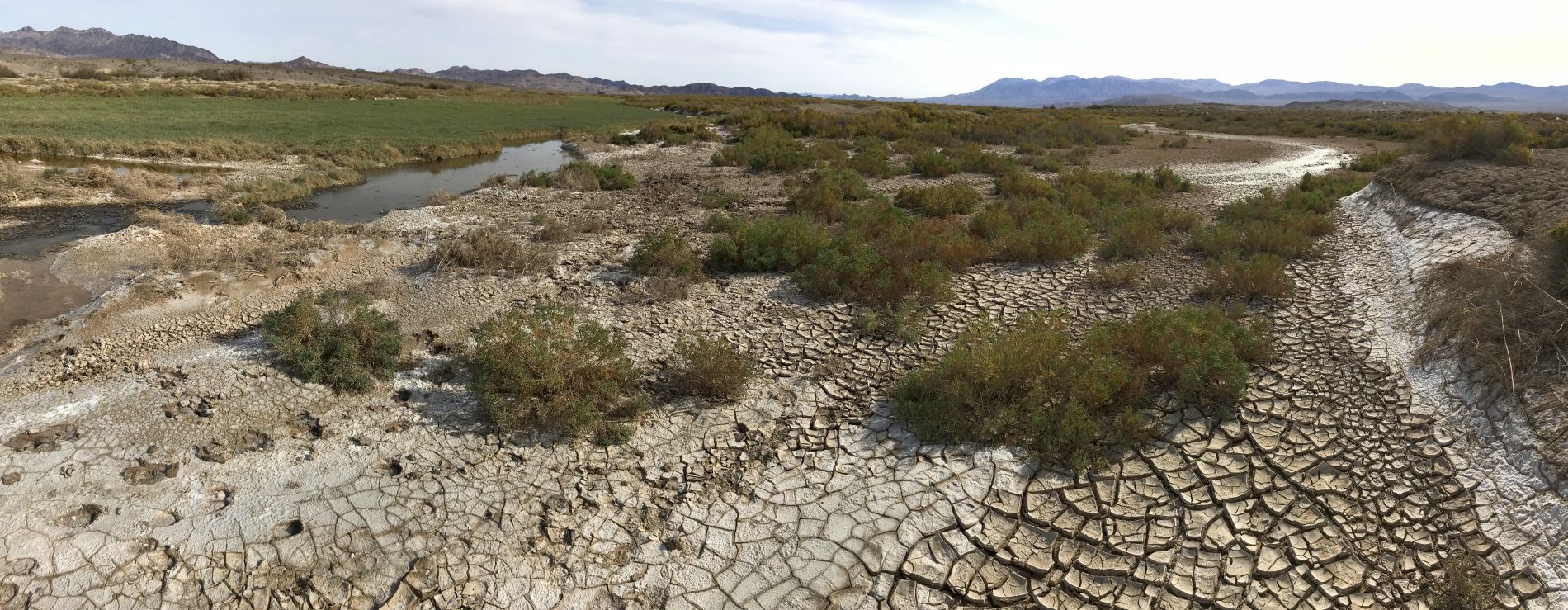
This view shows the exact spot where Valley Spring is marked on topo maps:

After 2 miles following the Amargosa River, we reached the spot where surface water begins. Past this spot, all channels were dry:


A picture of Jordan standing at the spot where Valley Spring's surface water begins:
We then crossed over to the southwest toward a minor fork and found more surface water:

Dried cracked mud with deeper indentations that were several inches thick:

Following along the bank of a river fork that contained heavy brush:

Two pictures of a bare (or possibly dead) Mesquite tree at Valley Spring:


We found these interesting salt formations along a dry riverbed seen in the next two pictures:


Spotting a Common snipe foraging through the mud and water for insects and worms to eat:

Common snipes have the longest bills of all snipes:

In the foreground, you can see how the NPS has come through here and cut down the Tamarisk which was growing:

As we followed a section of the second major river fork we had missed earlier, a long channel of water could be seen:

The next two pictures show Mesquite trees that have definitely died off:


Notice how the river channel would dry up in between sections of ponds in this fork:

We came across one more larger pond, which we hadn't seen in a while:

Panoramic of the final larger pond of Valley Spring that we ended up finding (click to enlarge):

One final smaller pond before we turned away from Valley Spring and the Amargosa River and hiked back toward our vehicle:

On the way back, we spotted a couple of these rusting barrels embedded in the soil:

The inside of the barrel had been filled up with soil:

As with every hike in the Owlsheads, we found bullet shells scattered across the ground:

We found quite a few colonies of fire ants hard at work as we neared the vehicle:

