


TRIP REPORT PHOTOS
At the end of Day 1, we camped on this bank above the main canyon wash. On Day 2, we woke up and headed up canyon (south) toward the range crossover saddle:

Our first side trip was to check out nearby Wingate Slot 4. The highlight was finding this massive wedged boulder which can barely be squeezed around:

View through Wingate Slot 4 from the backside of the boulder (tight passage is on the left):

Our very first view of Owlhead BM summit while continuing up the main canyon:

An impressive view of the front face of Sugarloaf Peak. The summit of Sugarloaf is near the center of the picture:

We then turned off into a short side canyon to check it out and found some impressive colorful canyon walls:

The red-orange layers brightened up the side canyon:

We followed the side canyon up to this narrow gorge and turned around here:

Next up, we explored what we could of White Ring Hill Canyon. Here, we have gone a short way up, already done some steep climbing, and are looking back toward the main canyon:

In White Ring Hill Canyon, it wasn't long before we encountered major dry falls too challenging to climb:

Bypasses of these major dry falls (which started occurring one after another) were also very challenging. So we called off exploration of White Ring Hill Canyon:

Back in the main canyon, we followed it up into the range. After some time, it began narrowing down. The view here shows the narrowest spot in the entire canyon:

The views of Owlhead BM were continuing to grow larger as we progressed up canyon:

We turned off into this small wash which made it easy to pass over the top of the range:

At our crossover saddle, we looked to the left and had this stunning view of Owlhead BM. Very few people have ever seen Owlhead BM from this angle:

As we headed down the other side, note the faraway silhouette of Owl BM:

After passing by one canyon, we entered into the drainage of this canyon and headed up it. This is the canyon which we would later call Owlhead BM Slot Canyon:

The glow of early evening lighting as we arrived at our Day 2 camp and had this view of Owlhead BM:

This was a fantastic place to camp overlooking Lost Lake, Owl BM, and the Quail Mountains:

Enjoying a peaceful sunset in the western Owlshead Mountains:

The moon beginning to glow high above Owl BM and Lost Lake. This was the end of Day 2 of our journey:

Waking up on Day 3, we immediately headed for the Owlhead BM summit. The morning sunshine was directly in our faces during the hike up:

To start with, we stayed to the right of this fairly deep canyon cut and followed alongside it:

Eventually, we found a good spot to cross it and attain the ridge on the other side (center of picture):

View looking back toward our tents (red circle) and the colorful landscape behind:

The terrain heading up toward Owlhead BM is quite rocky most of the way:

As we gained elevation, we could see a wider expanse of Lost Lake:

This was the only tricky part of the ridge, where we had to navigate around a bump to avoid some bad terrain:

On the right side, you can see the bump we avoided:

Heading to the summit, this was the steepest part of the climb:

Looking back down, you can see where we had crossed the wash earlier and started our ridge climb (top center of picture):

It was a cold, fiercely windy morning. The summit is directly above me in this picture:

Jordan and Tom were ahead of me as they climbed this final steep section to reach the summit ridgeline:

From there, it would just be a gentle final climb to the summit:

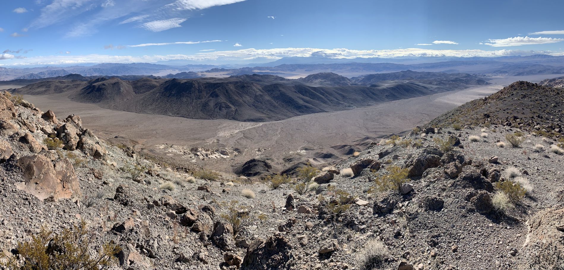
Upon reaching the summit ridgeline, we had this panoramic view looking to the east (click to enlarge):
The benchmark for Owlhead BM was placed in 1949:

At the summit, what looks like a partial wooden survey frame still stands:

My short summit registry entry on February 9, 2019:

For the views, we start to the southwest with Owl BM and Lost Lake:

The small mountain range seen in the distance is located on military land. The flat-topped summit on the right is called Pilot Knob (5,430 feet) and is 37 air miles away:

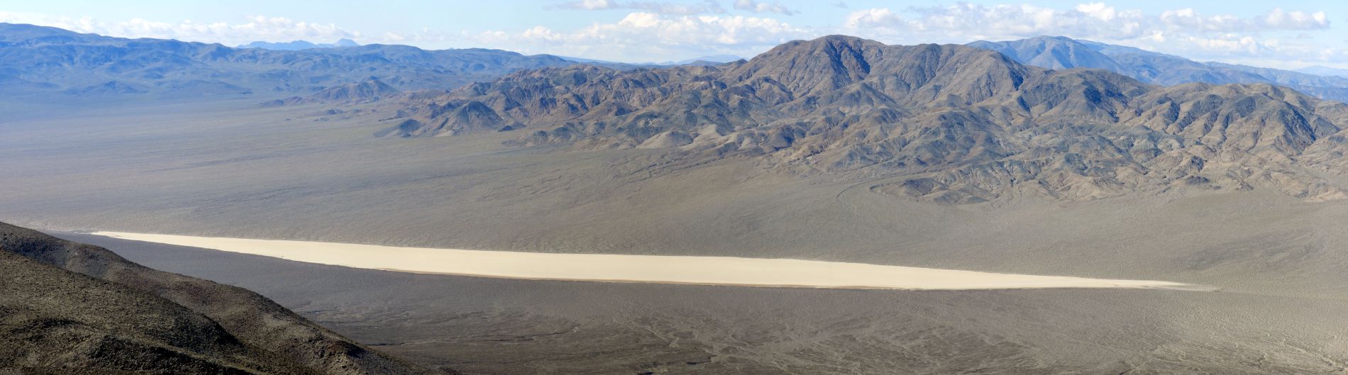
Zooming in on the middle of Lost Lake, which stretches 2.2 miles in length and 1/2 mile in width at its widest spot:

Lost Lake, Owl BM, and Brown Mountain all seen together:

Zooming in on Owl BM summit, which is a mere 258 feet higher in elevation than Owlhead BM:

Brown Mountain (5,124 feet) really stands out just behind Owl BM. However, this peak cannot be hiked to because it is on military land. Just to the right of Brown Mountain, Straw Peak (5,587 feet) can be seen:

Looking to the west from the summit:

This is what we call Wingate Dry Lake, a very isolated spot in Death Valley we had hiked to about 4 1/2 years earlier:

Now looking toward the northwest into the Panamint Mountains:

Porter Peak (left) and Sentinel Peak (right) are faintly visible through the clouds with a fresh layer of snow on their slopes:

Zooming in on Telescope Peak, which was mostly obscured by clouds:

Looking to the north into central Death Valley:

Zooming in on the salt flats of Badwater and lower foothills of the Black Mountains:

The summit ridgeline continues to the north for a ways:

Smith Mountain is on the left, while Funeral Peak rises up behind the ridge on the right:

Looking to the northeast from the summit:

The area directly below is seldom visited terrain in between Owlhead BM and the five Owlshead canyons with official names:

Spotting the very distinct Epaulet Peak in the distance:

Zooming in on the colorful slopes of Epaulet Peak (4,766 feet), a summit which I reached in December of 2010:

Rhodes Hill (lower center) and Salsberry Peak (middle center) were distinctly visible:

View to the east from the summit in the next two pictures:


Looking over toward where the Buckwheat Dunes are located but mostly out of view:

Some of the sand of what we call Summit Dune from the Buckwheat Dunes system can be seen here:

Ibex BM is the rounded summit near the left side of the picture:

The next two pictures show Owl Lake as seen from Owlhead BM:


Directly beneath the summit were these unique rock formations which would be interesting to check out sometime:

Getting a summit picture with Lost Lake and Owl BM in the background:

Two more pictures of our group on the summit, which included myself, Jordan, and Tom:


Panoramic view of Lost Lake and Owl BM from the Owlhead BM summit (click to enlarge):
Heading down from the summit now, we were actually taking a different route:

The new route had this very steep descent section which we took very slowly:

Looking back up the steep descent section we just came down:

We dropped into the canyon we were targeting as soon as it looked safe to do so:

The canyon was narrow right from the start and had a lot of quick bends:

Entering the upper end of the incredible 2nd Narrows of Owlhead BM Slot Canyon:

I was expecting the slot narrows to be nice based on satellite imagery, but I had no idea they would be this nice:

The high canyon walls were similar in color and beauty to what is found in Sidewinder Canyon and Mormon Point Canyon:

Being that conglomerate rock slot canyons are in short supply in the Owlshead Mountains, this canyon can be considered a must-do if visiting Owlhead BM:


The golden wall curves over in such beautiful fashion right here:

Getting pictures at two of the best spots in Owlhead BM Slot Canyon:

What a magnificent combo seeing this slot canyon and reaching the hardest summit in the Owlshead Mountains makes when done together:

Morning sunshine creeping into the dark slot:


Our group quickly lost sight of each other while passing through the slot narrows:
A longer passage in the 2nd Narrows with lots of unique shapes all around:

Looking up at a giant overhanging rock above the canyon:

Morning was a good time to photograph these narrows with good lighting:


A very impressive spot with overhanging rock shelves and tight narrows visible in the distance:
Such a smooth wash passes through the narrows:

Yet another impressive stretch of narrows with limited space to pass through:

Heading toward a more open section in the distance:

Just past here, the 2nd Narrows came to an end:

Looking up at the unique erosion high on the canyon walls:

We then entered the upper portion of the 1st Narrows, which were shallower but still quite nice:

A long section that winds back and forth for a while:

Throughout the two sections of narrows (except for the open middle section), there wasn't much visibility above the canyon:

Last picture of the 1st Narrows (I couldn't fit more due to report space limitations):

Upon climbing out of the canyon to return to camp (and pack it up), we found large pieces of a crashed dart:

Near camp, we spotted a Sun spider (or Wind scorpion), which is pictured here eating an ant for a meal:

These two pictures of the Sun spider were also added to our Wildlife Page:

After packing up camp, we began the hike down to the northern end of Lost Lake:

It had been nearly 9 years since I had visited Lost Lake, so I was very excited to be going back:

Jordan and Tom approaching the northern end of Lost Lake. Our route would allow us to walk the entire length of the dry lake:

Looking back toward the summit of Owlhead BM, where we had been standing four hours earlier:

Zooming in on Owlhead BM, note that it is a very colorful summit with red stripes (or rock layers):

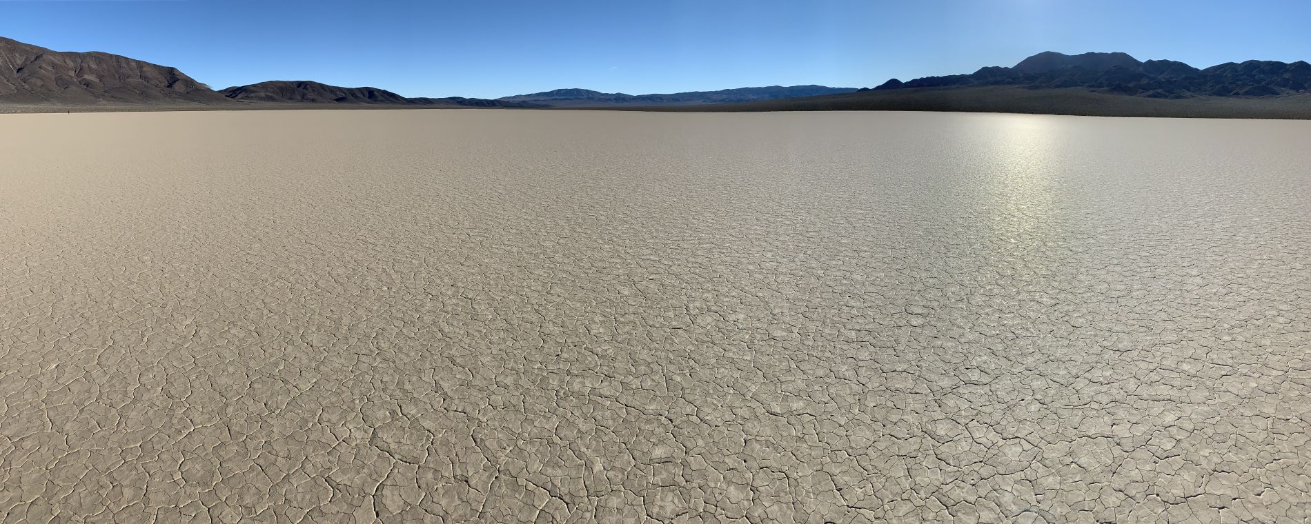
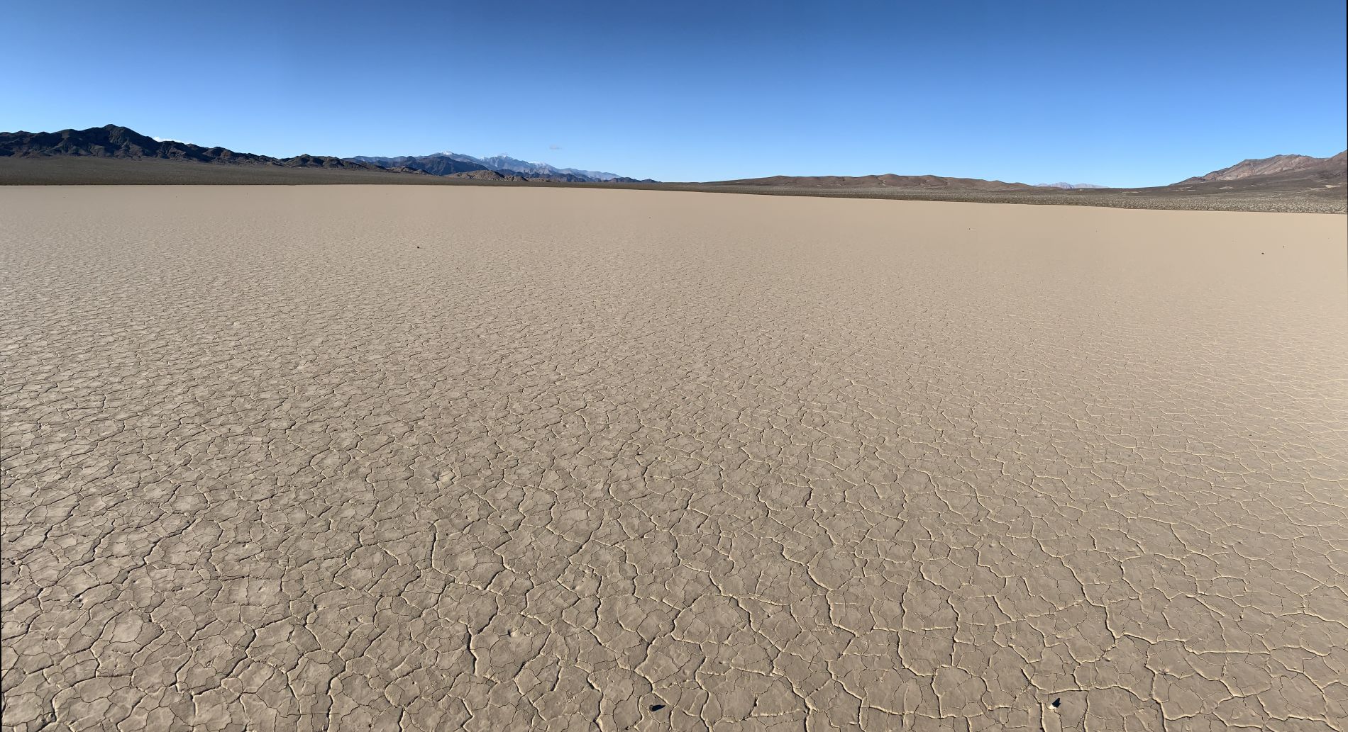
The afternoon sunlight was causing the playa of Lost Lake to glow. Check out the amazing patterns on the lake bed:

Looking back to the north at Porter Peak, Telescope Peak, and Rogers Peak far in the distance:

Telescope Peak was especially stunning from this angle on Lost Lake:

As we reached the middle of the lake, we looked over once again toward Owlhead BM:

Zooming in a little bit more to fully appreciate the challenging summit hike we had just accomplished:

Another look back toward the northern end of Lost Lake. Once again, note the surface designs:

Crossing Lost Lake from one end to another with our backpacks was an incredible way to end our 3-day backpacking trip:

Lost Lake panoramic looking south toward the Quail Mountains (click to enlarge):
Lost Lake panoramic looking north toward the Panamint Mountains (click to enlarge):

One of the little known secrets of Lost Lake is that it contains moving rocks just like The Racetrack:

While tourists visit The Racetrack every day and the place has become world famous, Lost Lake has never even been heard of by the majority of tourists:

Twin moving rocks leaving trails side-by-side behind them:
The moving rocks of Lost Lake are smaller in size than The Racetrack but more enjoyable to visit (in my opinion) due to the isolation and solitude:


One final picture of a moving rock on Lost Lake in the Owlshead Mountains:

And with that, our 3-day backpacking trip had come to an end. We reached our second vehicle a couple of hours later as darkness set in:
