


TRIP REPORT PHOTOS
Camping at the Eureka Sand Dunes for two nights in January of 2015 with below freezing temperatures at night but beautiful days:

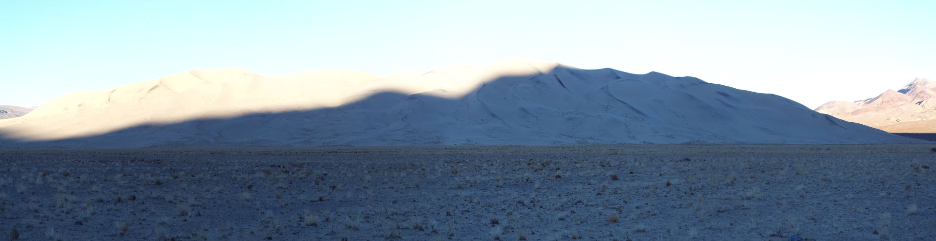
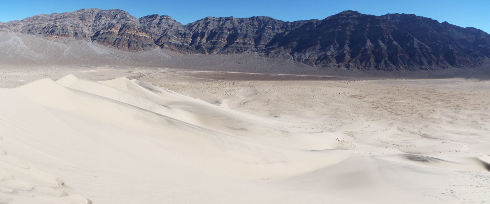
Morning sunrise panoramic of the Eureka Sand Dunes (click to enlarge):
A closer look at the contrast between light and shadows during the morning sunrise:

As the dark shadows descend down the dunes, the beautiful white sand is revealed:

The back half of the dunes as we continued walking in shadows across the valley floor:

A sunrise panoramic showing the last shadow disappearing from the right edge of the Eureka Dunes (click to enlarge):
We decided to head to the back half of the dunes first, targeting the small peak seen on the left:

As you can see here, there are more small peaks in the back half of the dunes which we did not get to. There is a lot to explore in this area:

Eureka Peak can be seen here towering above the back half of the Eureka Sand Dunes:

In the far background on the left side, 7,045 foot Saline Peak can be seen. Saline Peak must likewise have great views of the Eureka Dunes:

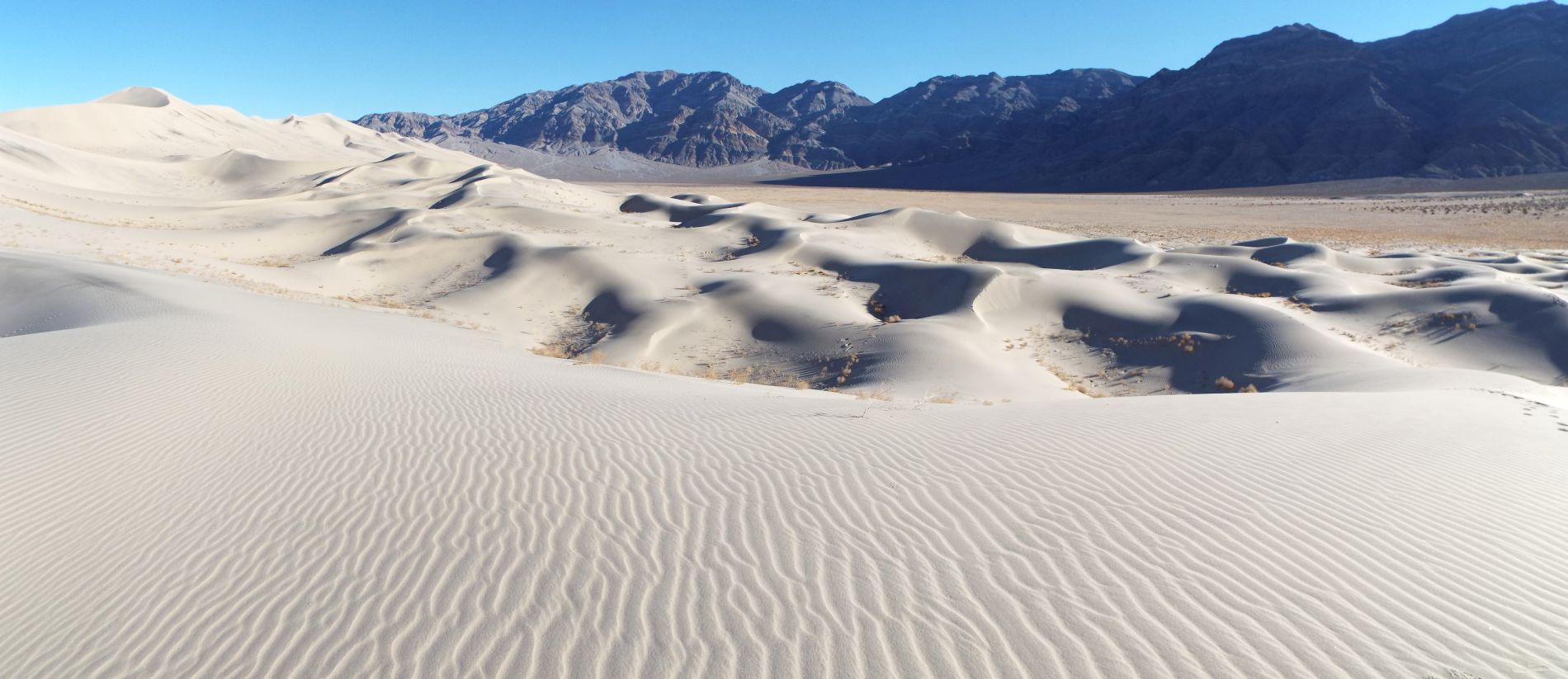
The next two pictures show distant small peaks of sand hills at the far back end of the Eureka Dunes. We wouldn't be exploring these today but these pictures give a nice look at them:


This large sand hill is located in the back half of the dunes and would be our first main target. To get there, we would first circle around and pass through some rarely explored areas:

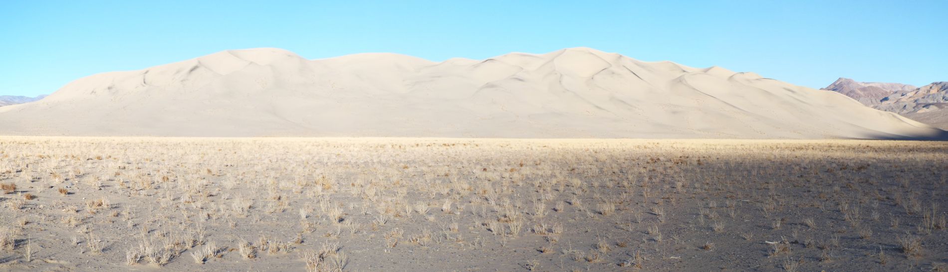
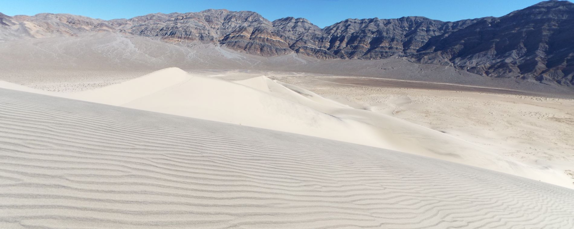
A full panoramic of the front half of the Eureka Dunes as seen when we neared the back half (click to enlarge):

As we got into the back half of the dunes, the ground became completely covered by sand:

Immediately, we noticed pretty ripple patterns in the sand:

Just as we had hoped, this area was untouched by any recent previous hikers, allowing for spectacular scenery and photos:

Notice how the ripple patterns were covering all of the small hills which were within view:

Every time I visit sand dunes systems in Death Valley (with the exception of the Mesquite Dunes), I'm looking to photograph pure untouched sand like this:

My brother Jim looking far off into the distance at the front half of the dunes which contain the mountain of sand that we would explore later in the morning:

Despite having probably the second highest visitation of any sand dunes system in the park, the back half of the Eureka Dunes contains many areas of untouched sand:

Note the circular ripple patterns in the sand which extend throughout the area here:

Extremely beautiful sand patterns which captivate the eyes:

A slight variation in the sand patterns perhaps caused by a small amount of wind blowing through:

From where we entered the back half of the dunes, there was still another 1 1/2 miles of sandy hills we could have explored as seen here far in the distance:

Notice the beautiful early morning lighting on the dunes which created dark shadows:

Looking far off into the distance about 1 1/2 miles away to our end destination at the front half of the dunes:

The next two pictures show some of the animal and creature footprints we found on the back half of the dunes. While human footprints ruin the scenery, these type of prints add to it:


This small sand hill was completely covered by sand patterns, with only a small animal's diagonal tracks breaking up the lines:

Keep in mind that the best time to photograph sand dunes is in the early morning or late afternoon because of the dark shadows which are created:

We continued walking along an untouched ridgeline as we circled around toward our first goal:

Miles of sand only interrupted by small plants surviving in the harsh environment:


More patterns, shadows, and plants along the low ridgeline we were following:
It is said that the Eureka Dunes store water beneath the surface very well and that perhaps allows plants to survive and sometimes thrive here:

Some lines in the sand patterns seemingly go on forever while others split into forks and more forks:

Drawing closer to the most northern peak in the back half of the dunes (seen on the left side here):

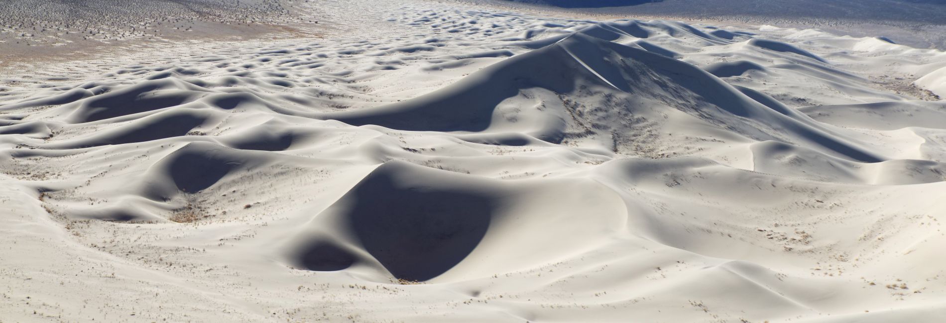
An incredible panoramic showcasing the sand patterns and shadows of the back half of the Eureka Dunes (click to enlarge):
We continued to have a perfectly formed ridgeline to walk across. We didn't feel bad about trampling the sand alongside it because the ridgeline will reform during the next windstorm:

We finally had our first view up the northern portion of Eureka Valley:

This was the first spot where we could see signs of a previous human presence:

A sharp ridge with animal tracks framed below Eureka Peak:

Continuing along the obvious route toward our first goal with long shadows created by early morning sunlight:

Looking to the northwest, there were a number of small bowls in the sand which had dark shadows:

An endless sea of sand looking back to the south:

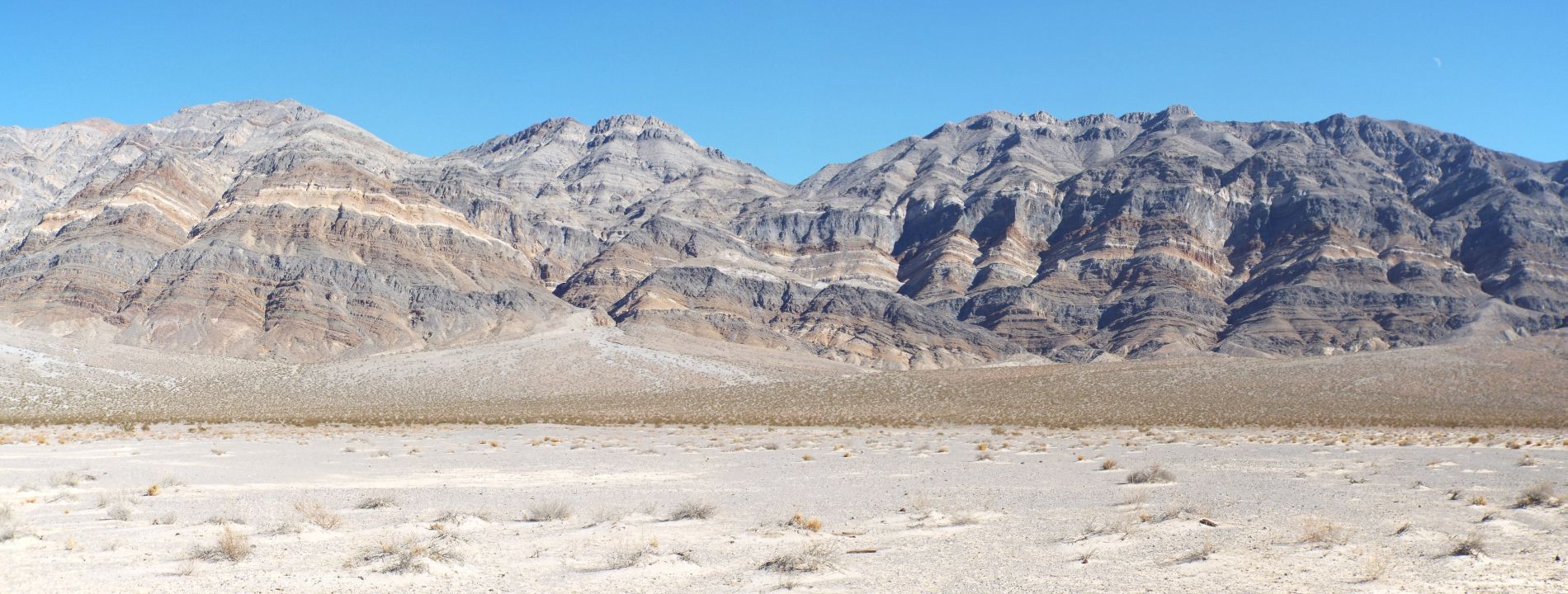
The portion of the Saline Range which drops into Eureka Valley is mostly a steep incline of small canyons, hillside terrain, and a few notable peaks:

As we got closer to our first targeted small peak, the sand climbing got considerably steeper and harder:

Notice the footprint tracks seen in the bottom half of the picture:


These tracks were made by a raven walking along the sand:
We had increasingly good views of the Last Chance Range cliffs:

Hiking up pure white sand in order to reach the small peak:

A picture of Jim hiking up to our first targeted peak:

More sand patterns, dark bowls in the sand, and small hills off in the distance:

Finally reaching the first small peak over an hour after starting out:

From the first small peak, this was the view looking back to the southwest along the ridge:

And this was the view looking to the north toward the large mountain of sand we were headed for:

A few oddly-shaped sand ridges off to the right side:

Jim standing on top of the first small peak. Keep in mind that this peak is located in the back half of the Eureka Dunes and is not part of the large sand mountain:


Curved ridgelines of sand adding to the scenic beauty:
Looking ahead to the front half of the dunes, you can see the two major peaks we were next targeting far in the distance:

In order to get to the first peak, we would first have to descend and follow along the ridgeline seen here:

The peak seen in the distance was now about 500 feet in elevation above us:

Coming across more beautiful sand patterns that were untouched:

The sand off to our right was now higher than we were:

All kinds of interesting animal tracks crisscrossing the dunes:

Check out the contrast in sand patterns with long straight lines on the left and circular designs on the right:


A closer look at some of the long straight lines. How long can your eyes follow one line?:
Looking back at the minor peak we had just descended from:

It is no easy task to climb 500 feet in elevation when it is being done on sand:

The sand mountain landscape provided more dramatic and scenic views up Eureka Valley:

There were areas where the valley floor encroached upon small dune peninsulas:

While climbing the front half of the dunes, we were continuously following in other people's footsteps:

The front half of the dunes is described as the sand mountain for good reason -- it has steep slopes and high peaks:

Looking over into the western side of Eureka Valley:

The climbing was so tough along these steep areas and progress was extremely slow because we kept sinking into the sand with each step:

A true mountain of sand rising up above Eureka Valley:

Notice the long ridge we have hiked along since leaving the smaller peak in the distance behind:

We still had a long ways to go to reach the first major summit:

From this spot, we could see nearly 2 1/2 miles of sand stretching behind us:

Panoramic showing the back half of the Eureka Sand Dunes (click to enlarge):
Having previous hikers' footprints detracts from the natural beauty but it also makes the climbing a bit easier:

The hike up to the sand peak in the distance was some of the slowest hiking I have done in the park. It seemed to take forever:

The Last Chance Mountains framed by the sand mountain we were climbing:

Approaching the first major peak with the second major peak now visible in the distance:

Looking north up Eureka Valley with Mount Nunn (7,830 feet) visible about 20 miles away (small bump in left center of picture):

This was the view we now had of the second major sand peak:

One of the endemic Eureka Dunes beetles walking along the high sand:

As we approached the first major peak, the terrain finally leveled off enough to enjoy the walk for a while:

Notice how much different the back half of the dunes look now that we have gained some serious elevation:

This the final path to the first major summit of the Eureka Dunes:

Looking back from the first summit at Jim and the back half of the dunes:

A picture of Steve with the second major summit in the background:

In order to complete our fairly extensive exploration of the Eureka Dunes, we would now need to hike over to the slightly higher second summit:

The first summit almost looks like a pyramid of sand when viewed from this angle after descending:

While the first major summit bump has great views of the back half of the dunes, the second major summit bump draws hikers closer to the Last Chance Range:

We could now see the South Eureka Valley Road winding for 10 miles away from the dunes:

The flat high point on the middle right side of the picture is P6980 ft:

The sand mountain contains beautiful sand valleys and ridgelines:

The steep climbing for this hike wasn't quite over just yet:

The second summit (or front summit) is the most heavily-visited spot on the Eureka Dunes:

You can see that with all of the trampled sand in this area:

A panoramic taken from the second peak of the sand mountain (click to enlarge):
A picture of Steve from the second peak with Sandy BM in the background directly in the middle. We climbed Sandy BM back in 2009:

A nice view of Eureka Dry Lake from the summit:

View of Eureka Peak from the summit of the Eureka Dunes:

View of Sandy BM (center left peak) and the far northern edge of the dunes:

We continued down the main sand ridge a short distance and then looked back at the second peak (which is apparently the highest summit on the dunes):

After this, we decided to head straight down the steep right side (eastern side) of the dunes:

Panoramic view looking across some sand patterns toward the northern end of the Eureka Dunes (click to enlarge):
Near the bottom of the sand dunes, you can see Jim hiking ahead:

The long slope of the sand mountain framing the Last Chance Range:

Taking one more look at distant Saline Peak while heading down:

One of the plants which is managing to survive on the sand dunes:

This is the endemic Eureka Dunegrass. Note the spiny leaftips which look like long, sharp thorns. The grass will be green in the Spring:

We came across an area of dried mud in two color shades:

Looking across the dried mud toward the sand mountain of the Eureka Dunes:

Before reaching the vehicle, we passed through an area of small volcanic rocks:

Panoramic showing the cliffs of the Last Chance Mountain Range (click to enlarge):
The next two pictures show views of the front of the dunes seen while driving back to the campground:


This older picture in my collection shows a Natural Landmark marker which used to be installed at the front of the dunes:

The final two pictures show Steve and Joe Silva visiting the Eureka Dunes 10 years before the collection of photos in this report were taken:


