
This is the first of a four-part series of reports which document my May 2012 backpacking trip through the Panamint Mountains with long-time friends and fellow hikers Shawn, Kathy, and Tobin. The story of this trip actually begins one year earlier in May of 2011. On that backpacking trip (which Tobin was also on), I had planned a route which would cover Happy Canyon, Surprise Canyon, and Hall Canyon. However, due to the unexpected extreme difficulty of bushwhacking up Happy Canyon and attaining the Happy-Surprise Ridge, it took us 3 days to reach Panamint City instead of the expected 2 days. Thus, Hall Canyon had to be dropped from the itinerary. In the end, it proved to be for the best, because it enabled us to spend more time exploring the areas we were in and set up the potential for another completely separate trip. Fast forward one year later and our group set out to backpack through the Panamint Mountains. For me, this was my fifth backpacking trip in the Panamint Mountains featuring Panamint City. For Tobin, it was his second. And for Shawn and Kathy, it was their first. Tobin lives in Concord and has spent around two weeks or so total hiking with me in Death Valley. Shawn and Kathy live in my town of Sonoma, and this was their fourth consecutive year doing a backpacking trip with me in Death Valley. On the previous years, we backpacked the Cottonwood-Marble loop, Anvil Springs Canyon area, and Indian Pass Canyon. Shawn is a very experienced backpacker and is currently about 2/3 finished with his own goal of hiking the entire Pacific Crest Trail, which is a remarkable accomplishment. Kathy, as I learned on this trip, is also an outstanding hiker and backpacker, even as she approaches the age of 50. As you will read in this series of reports, the route we took put her (and the rest of the group) through some harrowing and challenging situations. But she was undeterred and successfully overcame every obstacle that Death Valley threw at her. In view of this, I would like to give a heartfelt "nice job" to my entire group for succeeding on this great journey that we took. And now, on to the first day of our route.
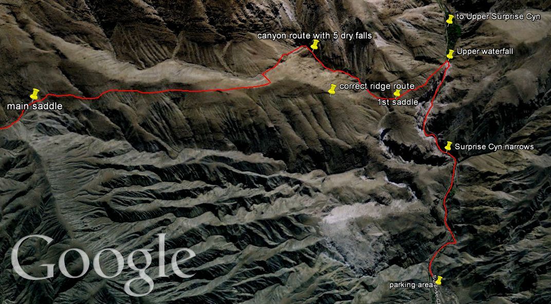
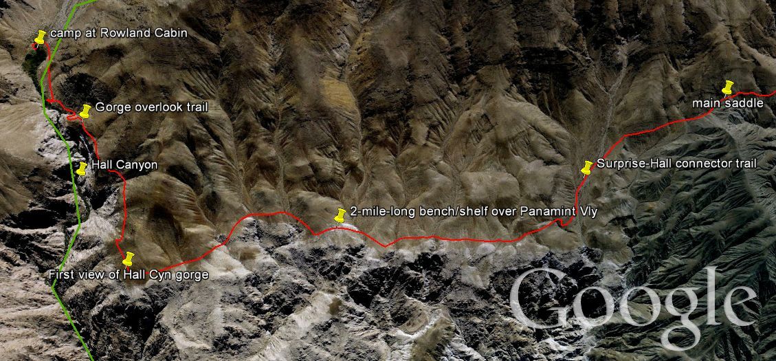
Middle Hall Canyon has to be one of the hardest places in the Panamint Mountains to reach. The reason for this is that there is no clear-cut easy way to get there. In the past, I had heard that there were basically two routes-- (1) crossing over from Jail Canyon via the Hall Canyon Cutover Trail or (2) hiking up from the mouth of Hall Canyon via the washed out mining trail. Neither of these options appealed to me because Jail Canyon was too far away from Panamint City, and in order to hike up from the mouth of Hall Canyon we would need to get permission from Indian Ranch to go onto their land and then do some serious route finding and scrambling. A friend in the park service helped me avoid these two issues when he told me last year about a secret trail which accessed Middle Hall Canyon from Lower Surprise Canyon. The implications of this potential trail were astounding. Such a route had never been documented before anywhere. It wasn't in any guidebooks, wasn't written up anywhere on the internet, and wasn't known by just about anyone. When it comes to parking in Lower Surprise Canyon and going for a hike, people had always only done that for two reasons. Either they were hiking Surprise Canyon or they were hiking up to Panamint City. So I was shocked to find out that it was possible to start at the exact same trailhead and parking area (at Novak Camp) and actually be hiking somewhere different... to Hall Canyon. After researching the hike on Google Earth, I could see that indeed there were sections of trail visible, and I was able to map out a potential route. Thus our group (after arriving the night before and getting some sleep) set out Saturday morning and began hiking the first mile up through the beautiful waterfalls and cascades of the Surprise Canyon narrows. At the top of the final waterfall, we turned sharply to the left and continued along a burro trail that mostly followed the rim of the Surprise Canyon narrows. Along the way, we had outstanding views down into the narrows. Eventually, the trail reached a few washed out sections, but we were able to pick the trail up again slightly higher up on the hillside. After reaching the first saddle, we dropped into a side canyon and began following it up. This was our big mistake for the day. In my planning, I had intended to hike up the next ridge over and stay out of the side canyons. As I told my group halfway up the canyon, this was because of my fear of encountering dry falls which would stop us. And sure enough, a major dry fall did put a one hour plus stop to our progress at the very top of the canyon. After climbing a series of smaller dry falls, we had made it to the very end where the hardest one of all of them awaited us. With exposure and difficult climbs on both sides, we tried the left side first. Shawn made it up, but Kathy and I did not. Tobin had already bailed out of the canyon earlier on and was wisely up on the ridge. So after 45 minutes or so of just standing around, caught between the top and bottom in an uncomfortable area, we dropped back down to the wash. Kathy and I then had a much easier time climbing the right side of the dry fall. After that debacle, we were finally on our way once again, following a burro trail toward a prominent saddle in the landscape. Upon reaching the saddle, we dropped down and kept following a series of burro trails that led us along the ups and downs of bumps that were found along a long rock shelf overlooking Panamint Valley. For the next couple of hours along the shelf (or bench), we had the best views of Panamint Valley that a hiker can find anywhere. We also passed by many barrel cactuses that were nearly as tall as people. At the end of the shelf, the burro trail turned sharply to the right and we came upon a stunning scene. We stood thousands of feet above the Hall Canyon gorge. Below us (but out of our view), were huge waterfalls dropping in Lower Hall Canyon. What we could see was just as impressive. We could see the entire lower portion of Hall Canyon, with its towering walls and thick brush along the canyon floor, and also epic views of Telescope Peak. For over a mile from that major bend in the trail, we hiked the Hall Canyon Gorge Overlook Trail, and it was simply breathtaking. We finally arrived at the Rowland Cabin (which is in shambles) and set up camp for the night. After pumping water out of a spring which ran right between the cabin and our tents, we went to sleep for the night. It was a sweet moment, as I had finally visited my namesake Death Valley canyon. To continue along with us on our journey after checking out the pictures below, visit the Trip Report for Jail Canyon- Camp & Corona Mine. Here is an overview of our route as seen on Google Earth (click to enlarge).
Middle Hall Canyon has to be one of the hardest places in the Panamint Mountains to reach. The reason for this is that there is no clear-cut easy way to get there. In the past, I had heard that there were basically two routes-- (1) crossing over from Jail Canyon via the Hall Canyon Cutover Trail or (2) hiking up from the mouth of Hall Canyon via the washed out mining trail. Neither of these options appealed to me because Jail Canyon was too far away from Panamint City, and in order to hike up from the mouth of Hall Canyon we would need to get permission from Indian Ranch to go onto their land and then do some serious route finding and scrambling. A friend in the park service helped me avoid these two issues when he told me last year about a secret trail which accessed Middle Hall Canyon from Lower Surprise Canyon. The implications of this potential trail were astounding. Such a route had never been documented before anywhere. It wasn't in any guidebooks, wasn't written up anywhere on the internet, and wasn't known by just about anyone. When it comes to parking in Lower Surprise Canyon and going for a hike, people had always only done that for two reasons. Either they were hiking Surprise Canyon or they were hiking up to Panamint City. So I was shocked to find out that it was possible to start at the exact same trailhead and parking area (at Novak Camp) and actually be hiking somewhere different... to Hall Canyon. After researching the hike on Google Earth, I could see that indeed there were sections of trail visible, and I was able to map out a potential route. Thus our group (after arriving the night before and getting some sleep) set out Saturday morning and began hiking the first mile up through the beautiful waterfalls and cascades of the Surprise Canyon narrows. At the top of the final waterfall, we turned sharply to the left and continued along a burro trail that mostly followed the rim of the Surprise Canyon narrows. Along the way, we had outstanding views down into the narrows. Eventually, the trail reached a few washed out sections, but we were able to pick the trail up again slightly higher up on the hillside. After reaching the first saddle, we dropped into a side canyon and began following it up. This was our big mistake for the day. In my planning, I had intended to hike up the next ridge over and stay out of the side canyons. As I told my group halfway up the canyon, this was because of my fear of encountering dry falls which would stop us. And sure enough, a major dry fall did put a one hour plus stop to our progress at the very top of the canyon. After climbing a series of smaller dry falls, we had made it to the very end where the hardest one of all of them awaited us. With exposure and difficult climbs on both sides, we tried the left side first. Shawn made it up, but Kathy and I did not. Tobin had already bailed out of the canyon earlier on and was wisely up on the ridge. So after 45 minutes or so of just standing around, caught between the top and bottom in an uncomfortable area, we dropped back down to the wash. Kathy and I then had a much easier time climbing the right side of the dry fall. After that debacle, we were finally on our way once again, following a burro trail toward a prominent saddle in the landscape. Upon reaching the saddle, we dropped down and kept following a series of burro trails that led us along the ups and downs of bumps that were found along a long rock shelf overlooking Panamint Valley. For the next couple of hours along the shelf (or bench), we had the best views of Panamint Valley that a hiker can find anywhere. We also passed by many barrel cactuses that were nearly as tall as people. At the end of the shelf, the burro trail turned sharply to the right and we came upon a stunning scene. We stood thousands of feet above the Hall Canyon gorge. Below us (but out of our view), were huge waterfalls dropping in Lower Hall Canyon. What we could see was just as impressive. We could see the entire lower portion of Hall Canyon, with its towering walls and thick brush along the canyon floor, and also epic views of Telescope Peak. For over a mile from that major bend in the trail, we hiked the Hall Canyon Gorge Overlook Trail, and it was simply breathtaking. We finally arrived at the Rowland Cabin (which is in shambles) and set up camp for the night. After pumping water out of a spring which ran right between the cabin and our tents, we went to sleep for the night. It was a sweet moment, as I had finally visited my namesake Death Valley canyon. To continue along with us on our journey after checking out the pictures below, visit the Trip Report for Jail Canyon- Camp & Corona Mine. Here is an overview of our route as seen on Google Earth (click to enlarge).
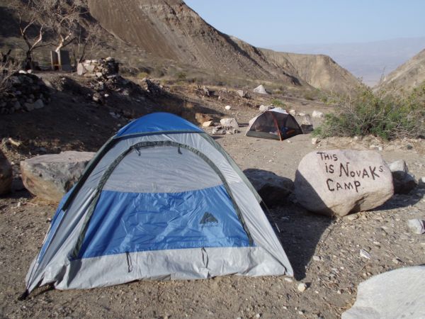
Camping at the Surprise Canyon parking area the night before our hike and waking up the next day:
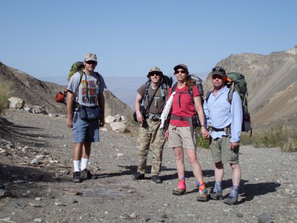
Our group left to right, that's Steve, Tobin, Kathy and Shawn:
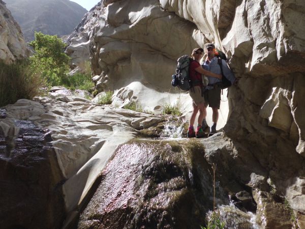
Kathy and Shawn reaching the dramatic waterfalls area of the Surprise Canyon narrows:
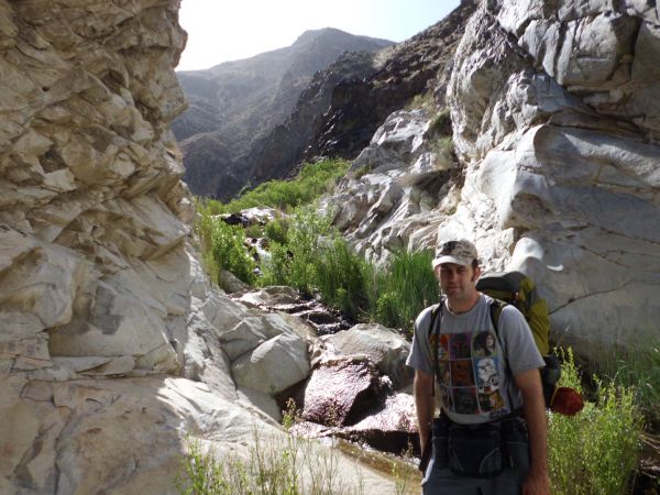
Steve nearing the top of the Surprise Canyon narrows:
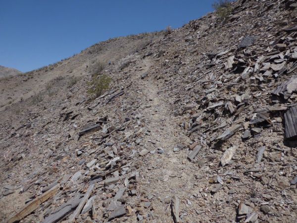
Once we reached the top of the narrows above the final waterfall, we turned sharply to the left and headed up the ridge overlooking the narrows:
If you look closely, you can see the faint burro trail that we followed up and around:

Shawn, Steve, and Tobin up above Surprise Canyon:
Looking down into the Surprise Canyon narrows as we gained a small amount of elevation:

Kathy and Shawn hiking along the burro trail which follows close to the rim:

Pausing to look at the impressive scenery below:
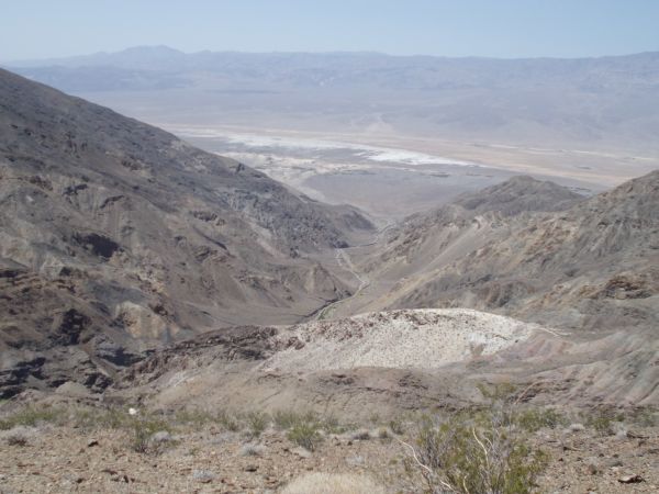
This was the view we had high above the Surprise Canyon narrows:

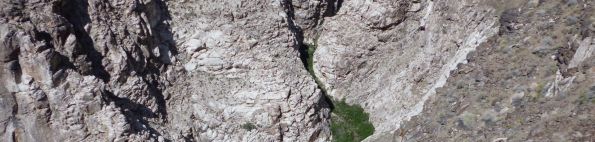
Zooming in on the narrows and waterfalls area below. For years we had hiked through this area but had no idea there was a viewpoint from above:
At this point, the rim trail got a little bit too close to the edge and there were a few washed out sections, so our group headed up higher on the hillside and connected with another burro trail:
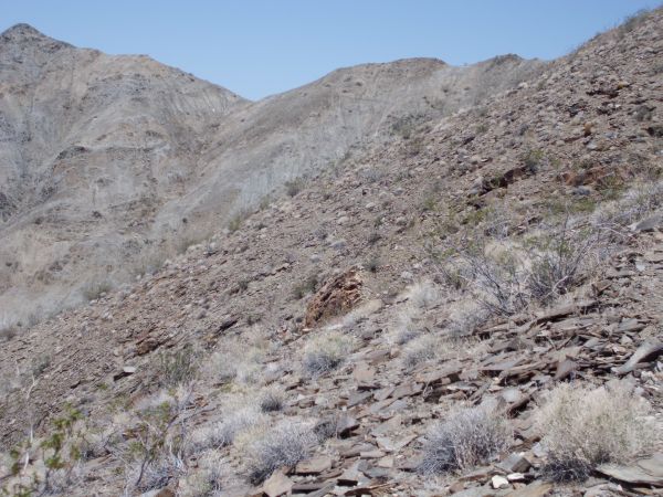
Now we could see farther down towards the mouth of Surprise Canyon:
Looking back around the hillside we had been circling around:
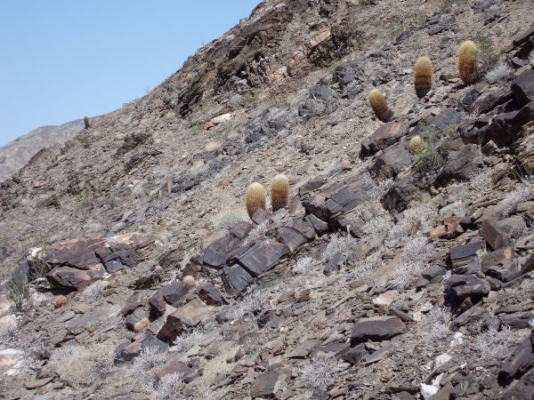
Soon, some of the tallest barrel cactuses I had ever seen in Death Valley started dotting the hillside:

A close-up of two of the barrel cactuses. We found taller ones (almost as tall as people) as we kept hiking:
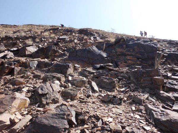
Following the faint burro trail up the hillside:
One final look back around the hillside before attaining the first ridge:


Upon attaining the first ridge (or saddle), we could see into Panamint Valley:
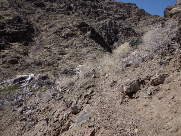
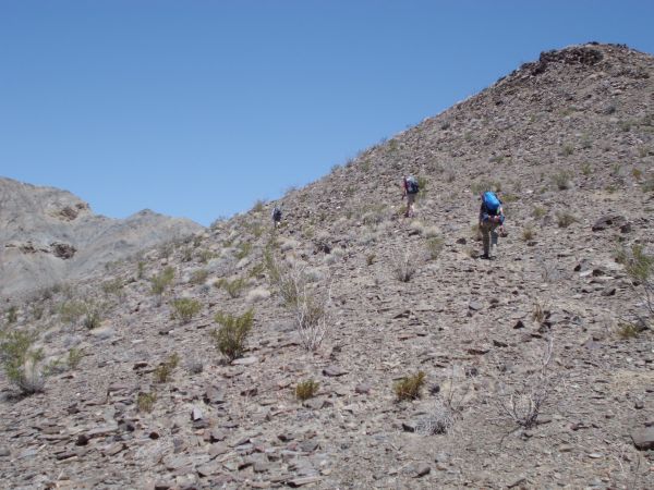
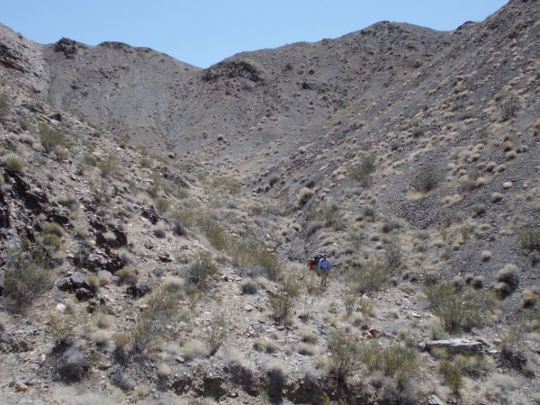
Here is where we made our first mistake of the trip. We followed the burro trail down the other side and began hiking up the canyon seen on the right. But we were actually supposed to hike up the ridge seen on the left:
Down in the canyon hiking now, I told our group about my concern that there might be dry falls in the canyon:
Sure enough, in the next four pictures you will see a series of increasingly difficult dry falls that we had to climb up and over:


Looking back down the canyon from the top of the 4th dry fall. All of this could have been avoided if we had just taken the ridge route:

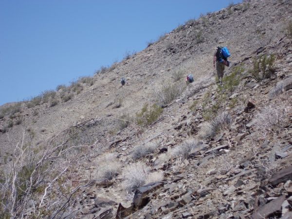
The canyon got steeper past the 4th dry fall:

And then we ran into a menacing obstacle. The 5th dry fall looked to be impassable and we began thinking about heading back down canyon:

Shawn and Kathy heading up the left side of the dry fall. Shawn made it up this part, but Kathy and I got stranded in a danger zone between the top and bottom. A strong gust of wind came in at this point and blew away my hat. When I got back down below 45 minutes later, I searched for it but just couldn't find it:

So Kathy and I headed up the right side instead and found that to be easier and less risky:
Finally above the 5th dry fall, we could breathe a sigh of relief. But we had just burned an hour of time and created a lot of drama for no reason:

Back on the ridge where we belonged, an even better view of Panamint Valley could be seen:
Once on the ridge, we quickly picked up the burro trail once again:

Zooming in on Panamint Valley from this point on the ridge. Better views were yet to come:
The burro trail continued on the left side of the ridge with very gradual elevation gain:
Looking across the way to some interesting hillsides:
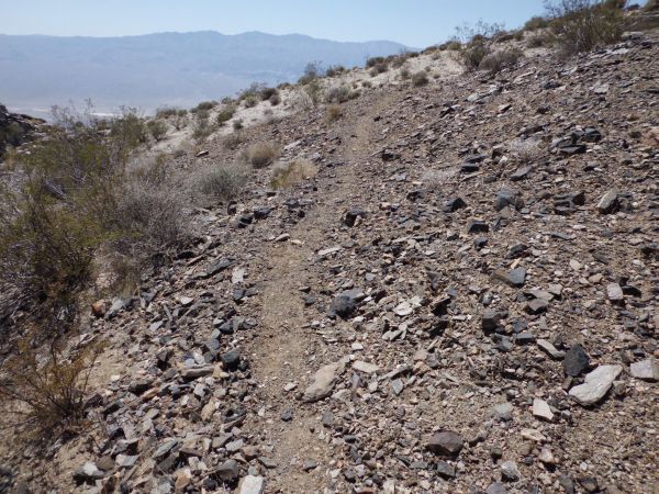
Notice that the burro trail was fairly easy to see and follow:
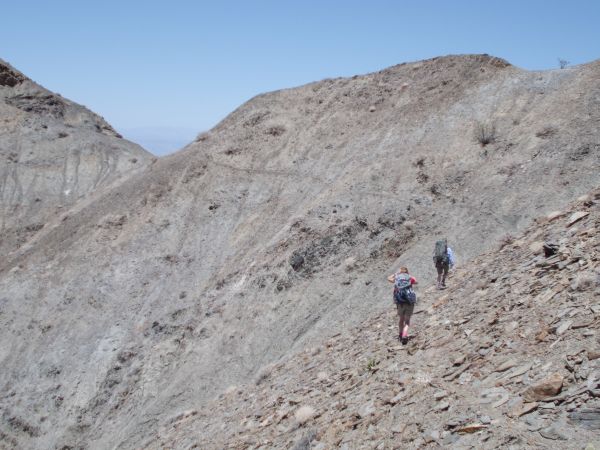
The main saddle we were ultimately heading for soon appeared off in the distance:

Up ahead we could see both the saddle and a trail winding around the hillside towards it:

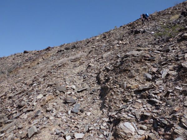
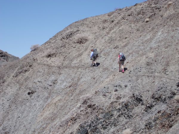
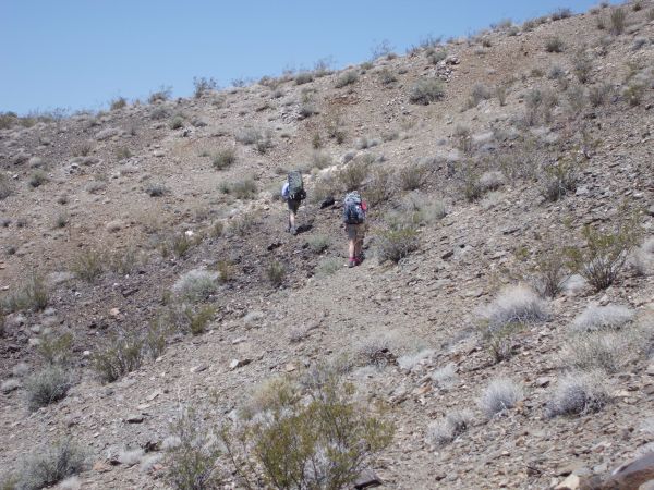
Steve backpacking up on this little-known route connecting Surprise Canyon to Hall Canyon:
Two final pictures before reaching the saddle we were heading for:

Reaching the saddle and looking off into the distance at the next section of our hike:

A close-up of Lake Hill and the Panamint Dunes way off in the distance:
As we dropped down from the saddle, the route was not that obvious, so we followed the gully for a while:
But soon we picked up another burro trail following along the base of the hillside:

Looking back at the saddle after we had gained some distance from it:

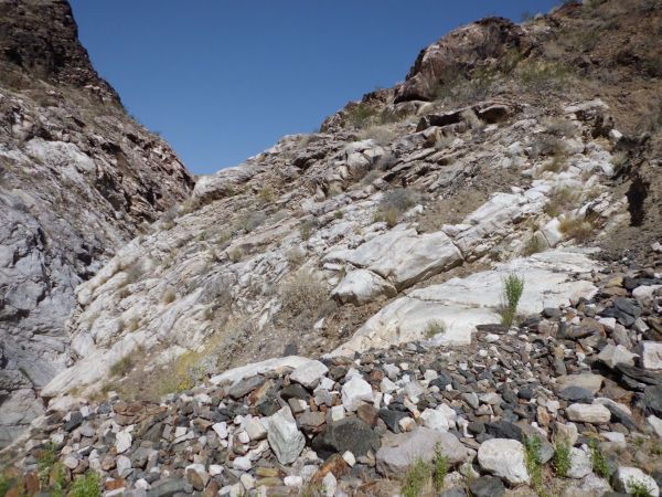
Reaching the edge of the cliffs we were hiking along and looking over a dry fall:

We were high above Panamint Valley at this point:

Here is where we found the extremely large barrel cactuses, 4 feet tall and higher:
We continued up and over several small bumps for a short time:

And then as we looked across, the somewhat flat 2-mile long shelf (or bench) that we were hiking on high above Panamint Valley became clearer:

The bench followed close to the edge of the cliff most of the time, but kept a safe distance away:
The bench is a long flat area (but sometimes bumpy) in between the cliffs to the left and the hillsides to the right:
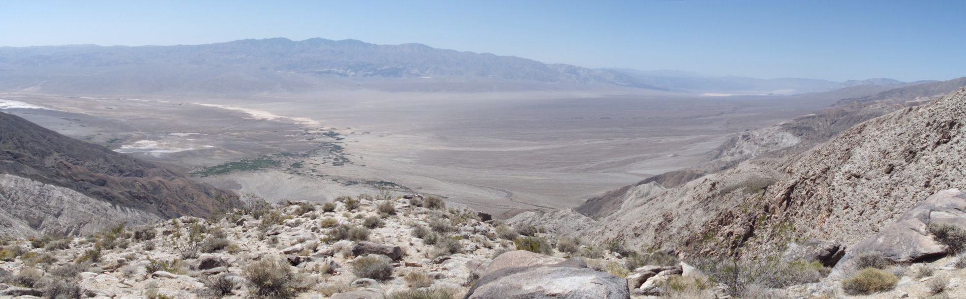
Panoramic overlooking Panamint Valley from along the bench (click to enlarge):

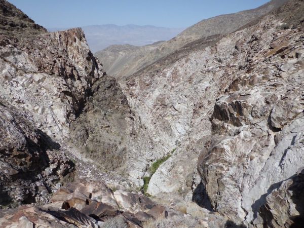
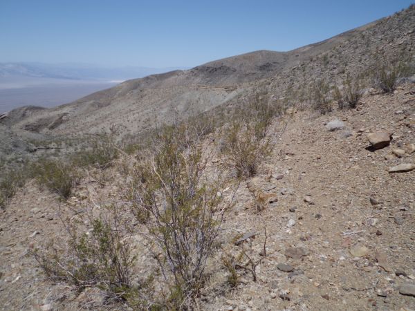
A view of the terminus of Hall Canyon far below:

Looking straight down from the spot where I stopped to eat lunch:

Looking at Indian Ranch far below on the floor of Panamint Valley:

At a few spots, the cliff edge would push into the hillside, so it was necessary to navigate around these areas:

Circling around one of the areas which I'm talking about:

The trail continues to steadily follow the bench:

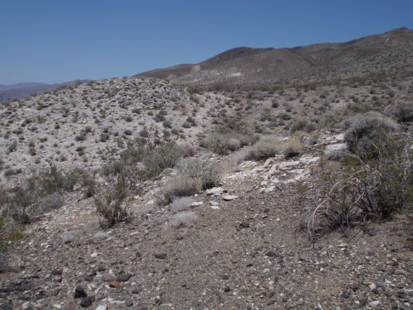
Passing by one of the many gullies which flowed down towards the valley:
The burros have done a great job creating and maintaining these trails which lead all the way from Surprise Canyon over to Hall Canyon:
Looking back at a couple of the areas which we had to circle around:

The trail soon turned around a sharp bend to the right. But first, one last look out at Panamint Dry Lake:

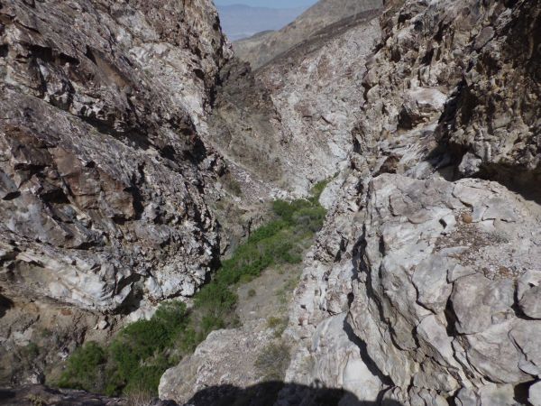
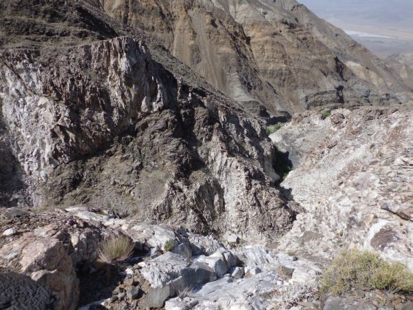
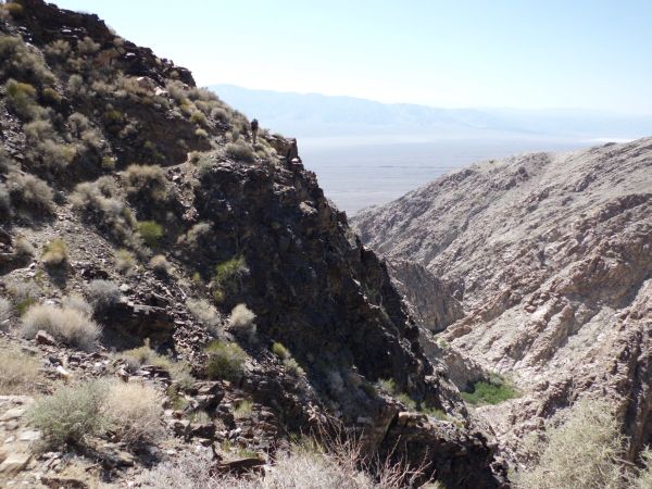
As the trail turned the corner, we came face to face with the Hall Canyon gorge:
Now looking toward the east, we had an amazing view of Telescope Peak:
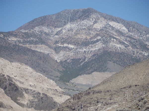
Zooming in on Telescope Peak. This is quite a special view which most people have never seen:

Steve on the portion of the trail known as the Hall Canyon Gorge Overlook Trail:
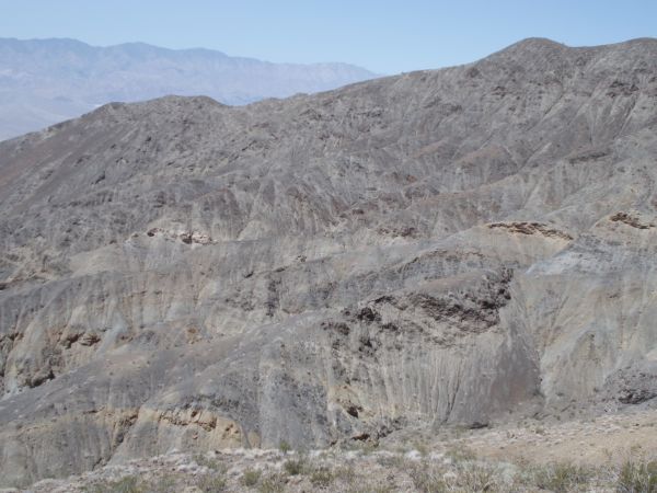
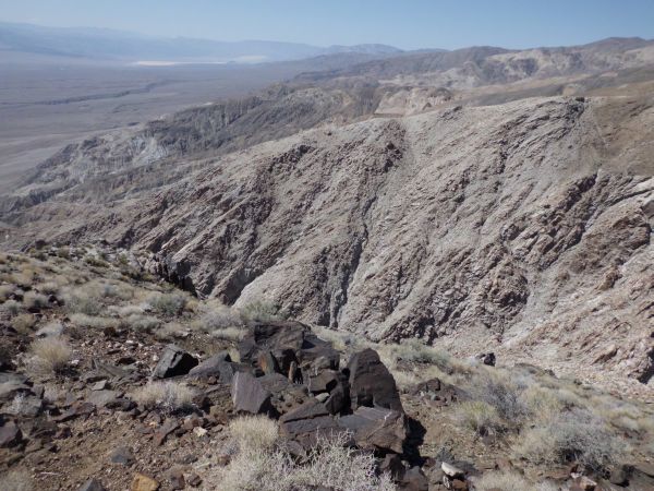
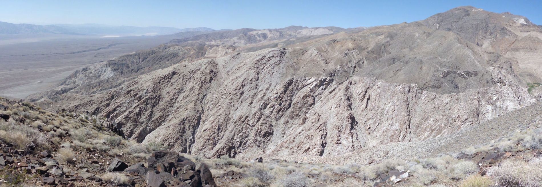
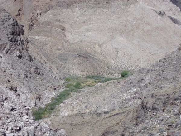
Panoramic overview of the Hall Canyon gorge from above (click to enlarge):

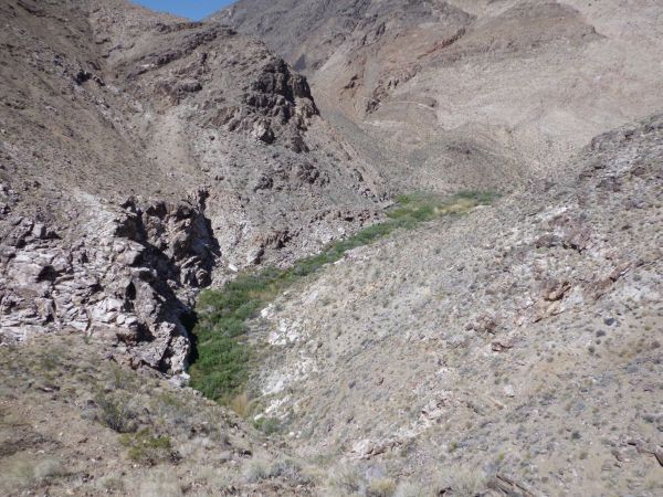
Far off into the distance we could see the beginning of the Hall Canyon spring, which was our destination:
The gorge overlook trail cuts into the hillside thousands of feet above Lower Hall Canyon:


Following the trail as it headed directly toward the creek:

As we drew steadily closer, the views continued to be more impressive:
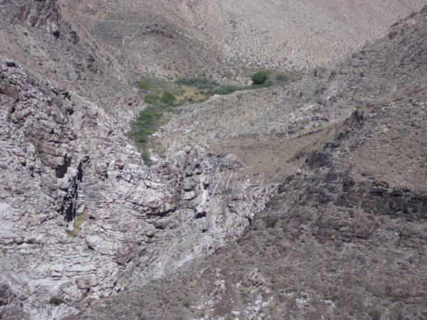
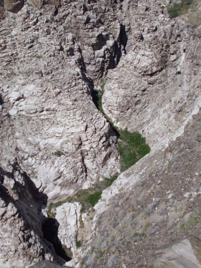
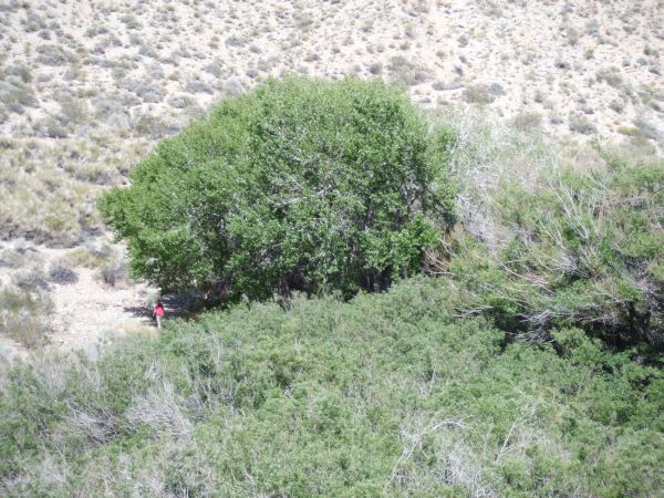
Can you pick out the tall Cottonwood trees in the midst of the spring?

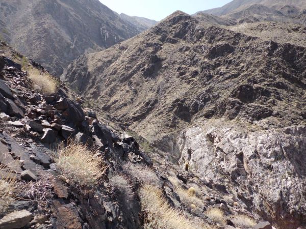
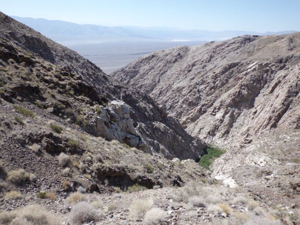
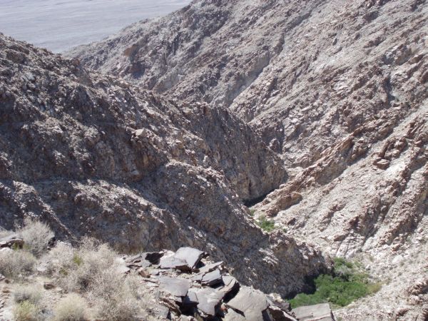
Looking down into the Hall Canyon gorge from high above:

Another easy to follow trail wrapping around the hillside:

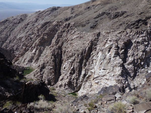
The walls of Hall Canyon shoot straight up into the sky:
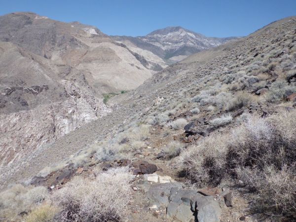
Looking back down Hall Canyon from about the 1/2 way point on the trail:
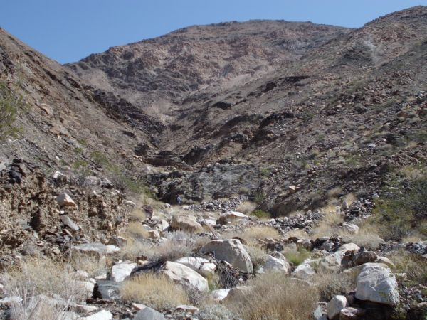
As you can see, the canyon floor is quite choked with vegetation:

Looking straight down into Hall Canyon is spectacular but scary:
Two pictures showing the early part of the gorge section:

Drawing ever closer to our final destination on the first day:
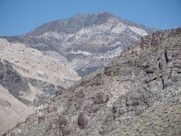
Not to be forgotten is the outstanding view of Telescope Peak from all along this trail:
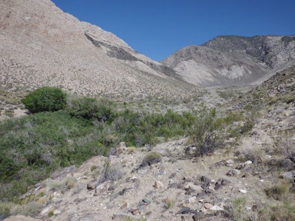
Lower Hall Canyon is a very inaccessible place for hikers due to the thick brush and waterfall drop-offs:
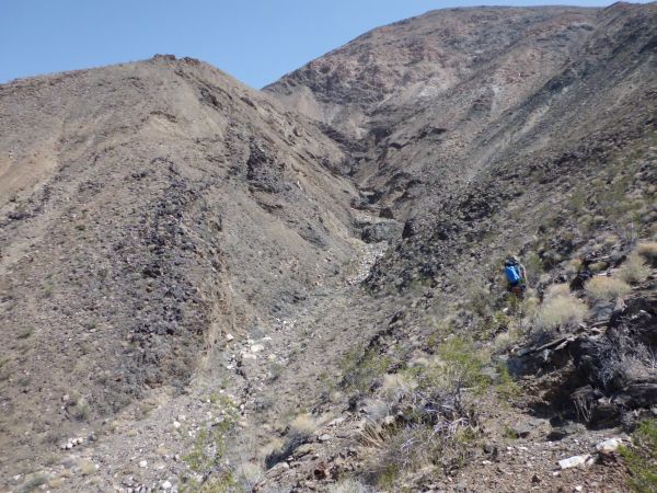
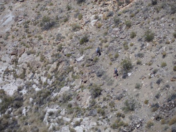
Tobin coming around the hillside high in the picture:

A closer view with Panamint Valley in the background:
Hall Canyon has some very tight narrows with towering walls on each side:

Almost to the beginning of the creek area now:
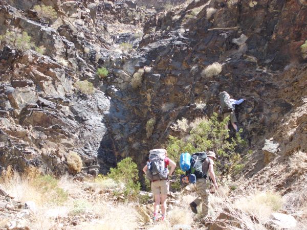
Shawn and Kathy down on the canyon floor as they lead the way:
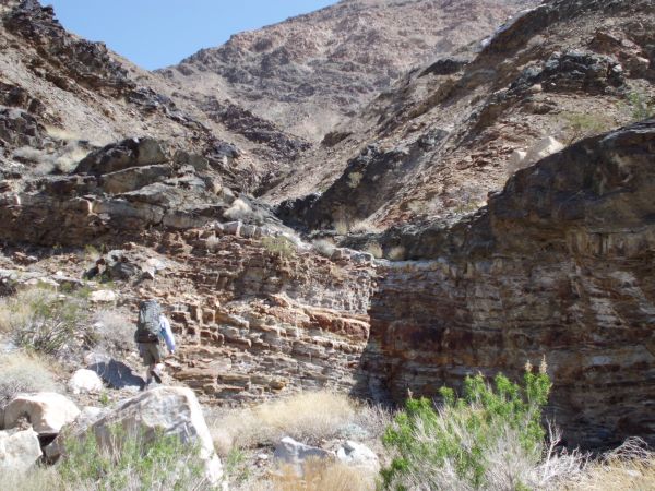
Once I reached the canyon floor, rock walls became evident in several places:

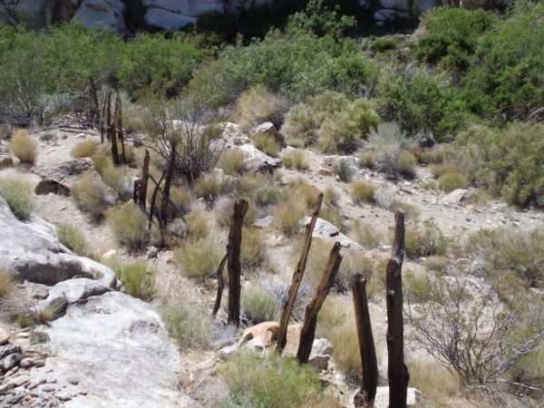
The remnants of what appears to be an old fence above the creek:

A lot of water flow could be heard but not seen. After looking around through the brush for about 15 minutes, I finally found a place with easy access to water. I then pumped out some water and drank a quick 32 oz. before filling up my bottles:

Next, I continued hiking toward the beginning of the creek to look for our planned camping spot:
The next three pictures show the Cottonwood trees which I circled around to reach and set up camp:


It was the early evening now, but the sun was still shining and it was hot out. Thus, we set up our tents in the shade:

View looking out of my tent at the brush and Cottonwood trees:
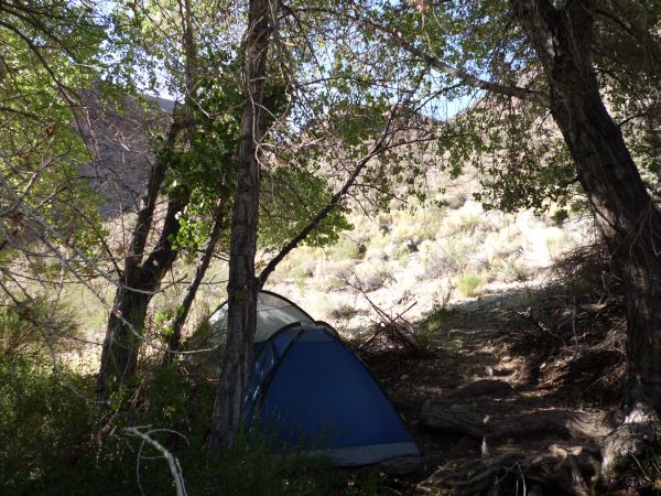
Notice how our tents were within the line of shade to help us stay cooler:
The Rowland Cabin was very close to our tents, as was a very small stream with flowing water:
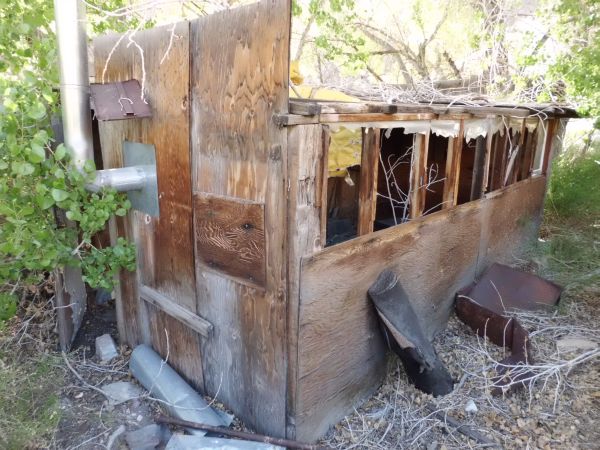
In better days, this door was probably kept latched by hikers, but we found it open:

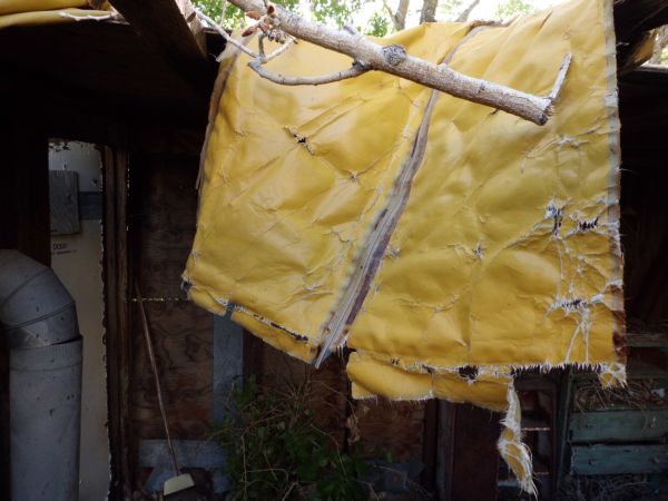
The insides of the Rowland Cabin are better left to the imagination. Safe to say, it has seen better days. And as can be seen here, the roof is also in bad shape. To continue on with us in our journey, read our first Trip Report for Jail Canyon: