
TRIP REPORT PHOTOS
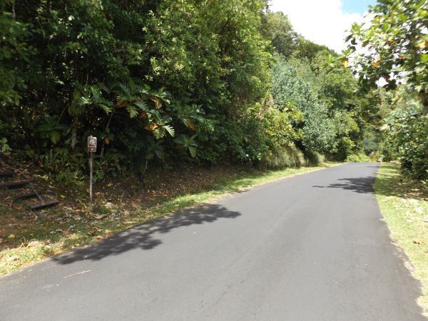
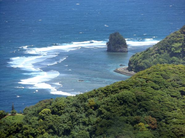
The trailhead is located a short distance from the Lower Sauma Overlook parking area along the coastal road:
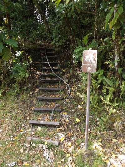
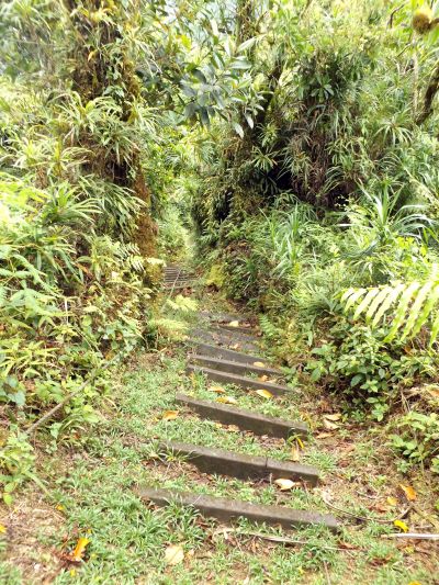
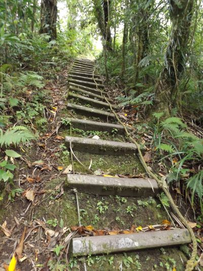
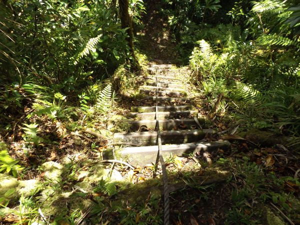
The hike starts out immediately with the first ladder climb of the day. This is the first of 56 ladders encountered along the route:
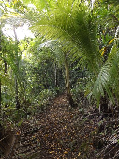
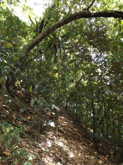
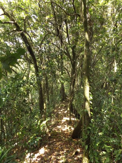
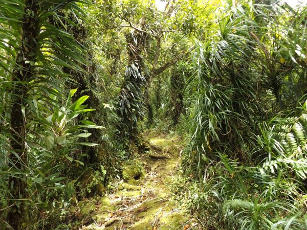
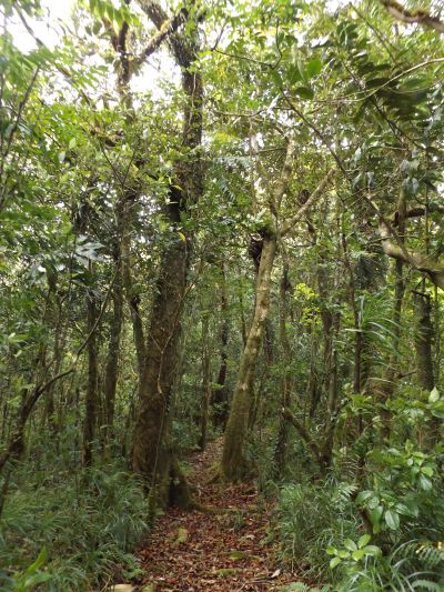
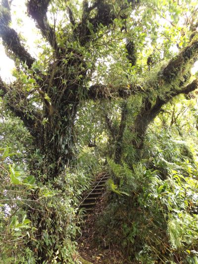
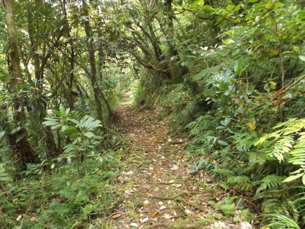
The rainforest scenery is beautiful right from the start along the trail:
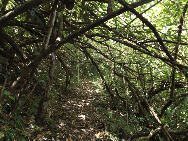
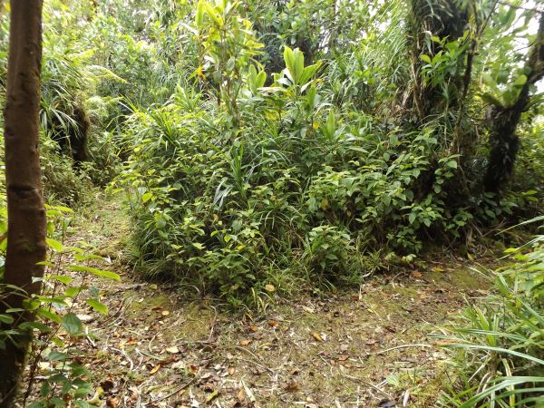
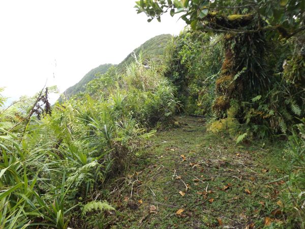
If the trail was not maintained reguarly, areas like this would quickly become completely overgrown:
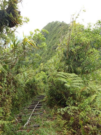
The trail is now steeply climbing up the Sauma Ridge:
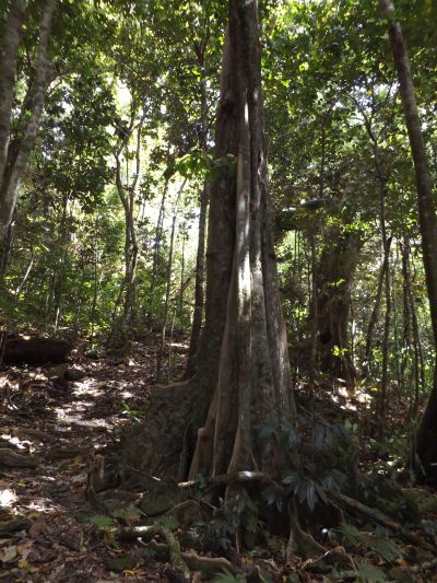
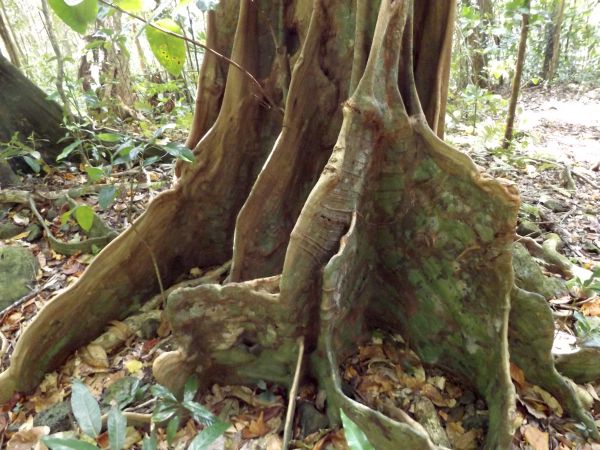
There were some impressive Tahitian chestnut trees growing on the slopes of the mountain:
Every single Tahitian chestnut tree has a unique look to it because of the trunks, buttresses, and root systems:
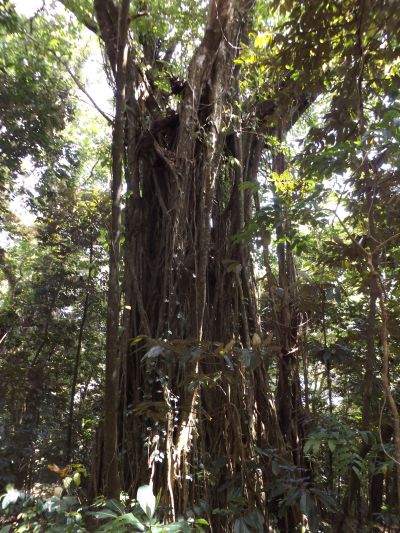
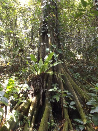
Coming across an impressive Banyan tree a short time later:
Banyan trees are among my favorite trees to check out and photograph in the South Pacific:
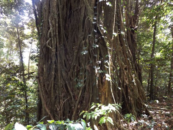
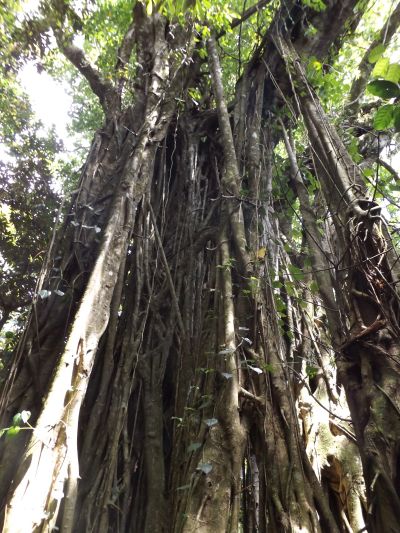
What makes Banyan trees so impressive are the aerial prop roots which grow so extensively all around:
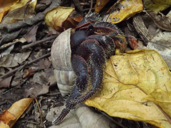
This crab looks like it's almost ready for a larger shell:
With the ridge having such a steep slope to it, many trees and branches overhang the trail's switchbacks:
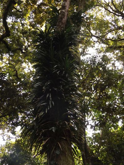
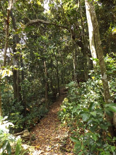
It is rare to find a large tree all by itself that is not being covered by some other type of plant or vine:
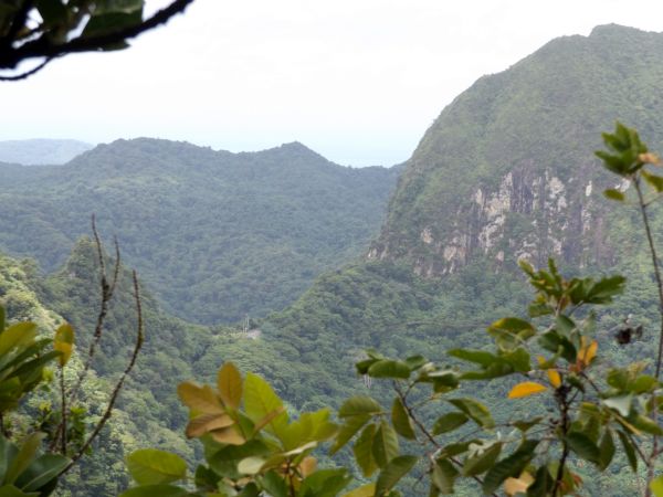
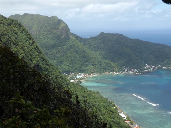
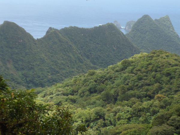
Looking out to the east, Olo Ridge (front ridgeline), Tagau Mountain (middle peak), and Palapala Mountain (back right peak) were all visible:
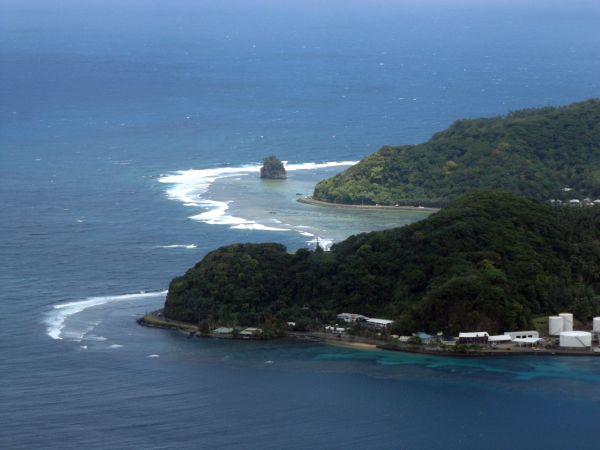
The three peninsula extensions visible are Vainuu Point (front), Tapisi Point (middle), and Papaloa Point (far back):
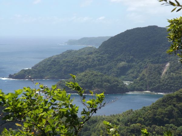
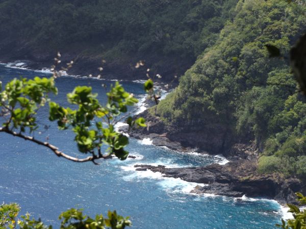
The rocky shoreline along the northern coast looked rugged and inaccessible:
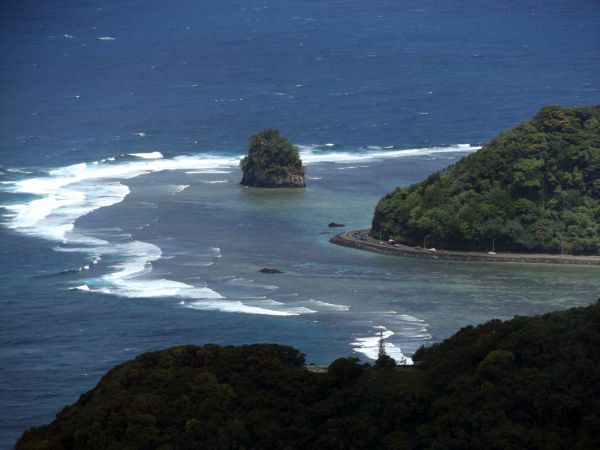
The trail soon leveled off for a short while as it followed the top of the ridgeline. Notice how the terrain drops off on both sides:
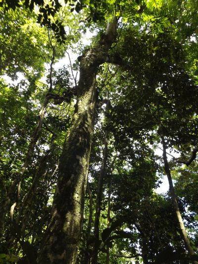
A very large tree growing high above the trail:
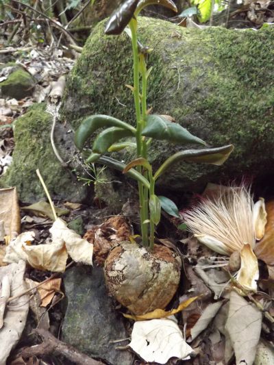
The Fish Poison tree (Futu tree in Samoan) is the dominant forest tree through this area. This is a Fish Poison fruit which has fallen to the ground and sprouted. The NPS told me that the fruit was used in earlier days to poison fish:
A Tahitian chestnut tree partially covered with vines and plants taking root:
Notice how a Bird's Nest fern has taken root and is growing on this branch stretching across the trail:
Many of the tree trunks were covered with a layer of green moss:
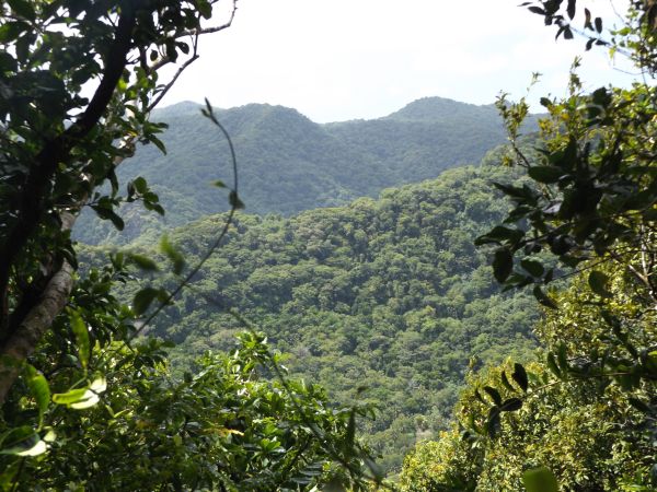
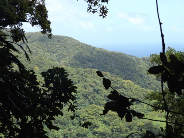
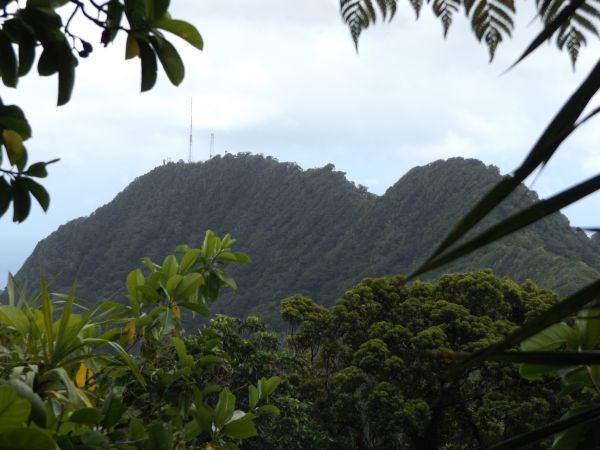
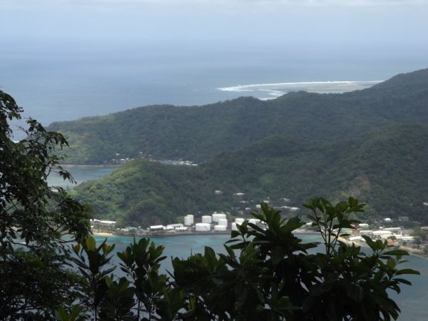
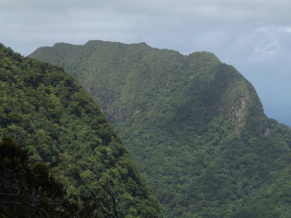
I managed to get a look at faraway Mount Alava summit through an opening in the brush:
Visible in the distance to the west are two of the many ridgelines which climb from the coast to the mountain top ridge:
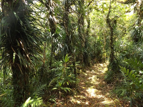
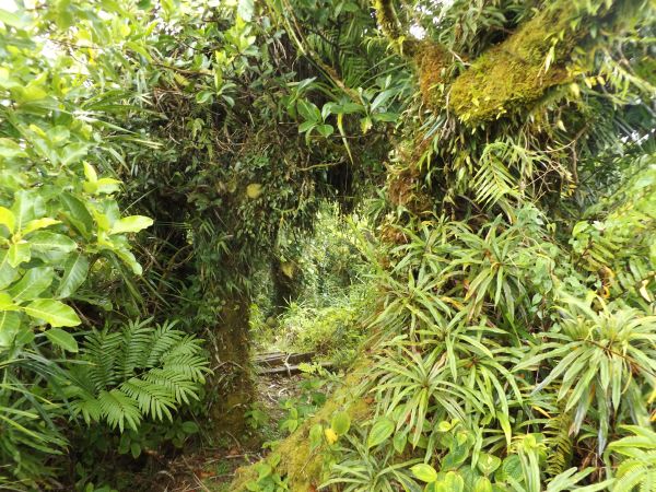
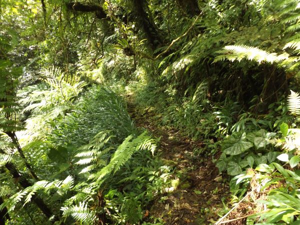
The greenery through the next portion of trail was among the most visually impressive I have ever seen in the South Pacific:
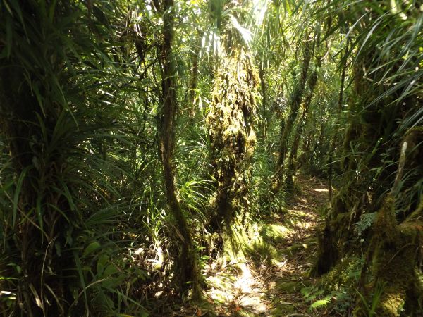
Tree trunks and branches through this area have been completely taken over by other plants:
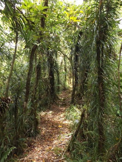
Walking on the trail which cuts through the middle of this greenery was quite amazing:
This rest area and viewpoint provided a nice spot to take a break and enjoy the views:

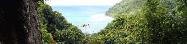
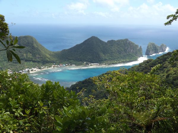
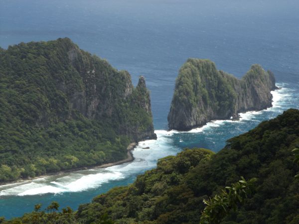
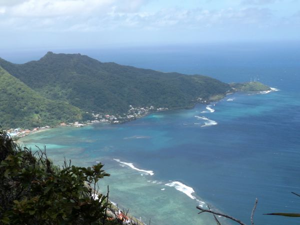
The peninsula visible in the distance contains some of the most spectacular scenery found along the north coast:
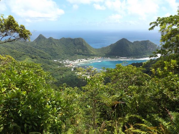
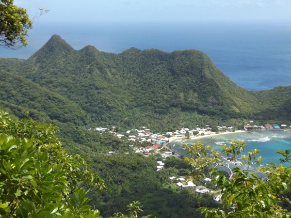
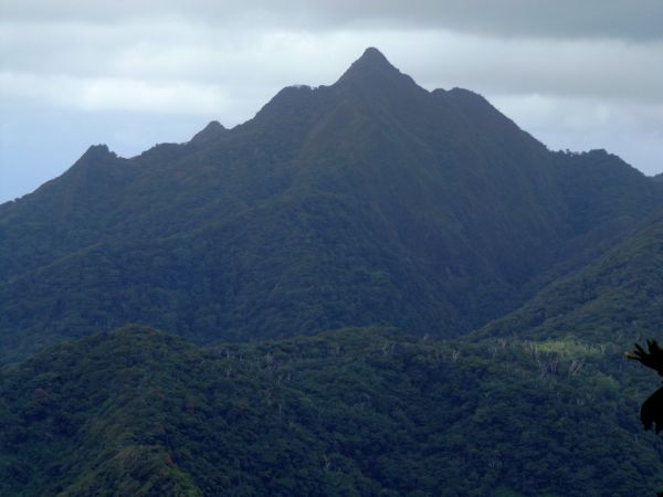
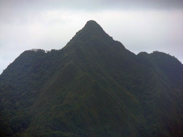
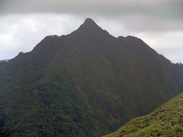
This is Siuono Ridge, flanked by Mauagotula Peak (991 feet) on the left and Leaoao Peak (808 feet) on the right:
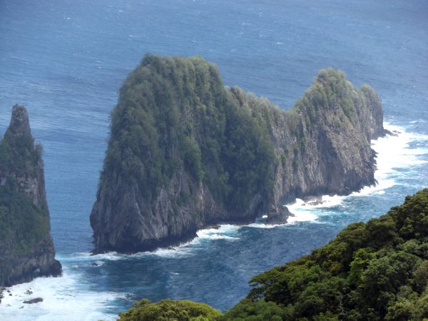
The northern end of the peninsula (before it gets broken up by Vaiava Strait) is topped by Polauta Ridge:
The low saddle visible here is crossed by the Tuafanua Trail, which allows you to access a hidden portion of coastline and see alternate views of Pola Island and Cockscomb Point:
Pola Island (visible here on the right) is separated from the mainland by Vaiava Strait:
A closer look at Vaiava Strait and Pola Island, which has a height of 438 feet (according to my topographical map). Noddies, frigatebirds, and brown boobies like to nest on these cliffs:
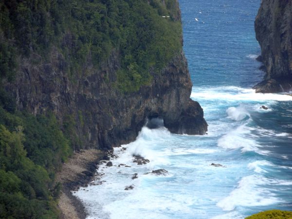
Zooming in on a sea arch that is visible at the tip of the mainland. You can almost get to this sea arch on the Pola Island Trail, but not quite due to safety reasons because the rocky beach runs out:
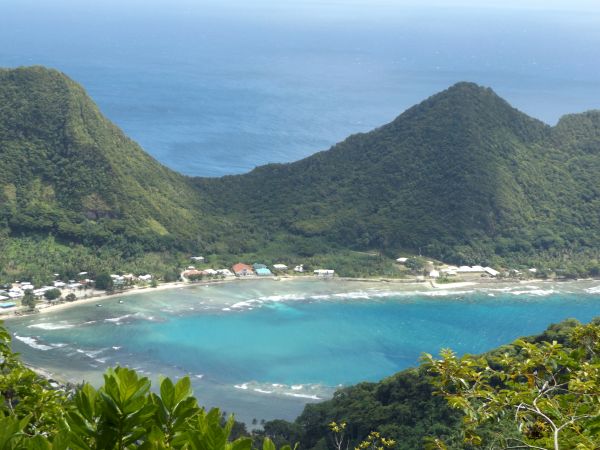
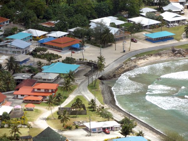
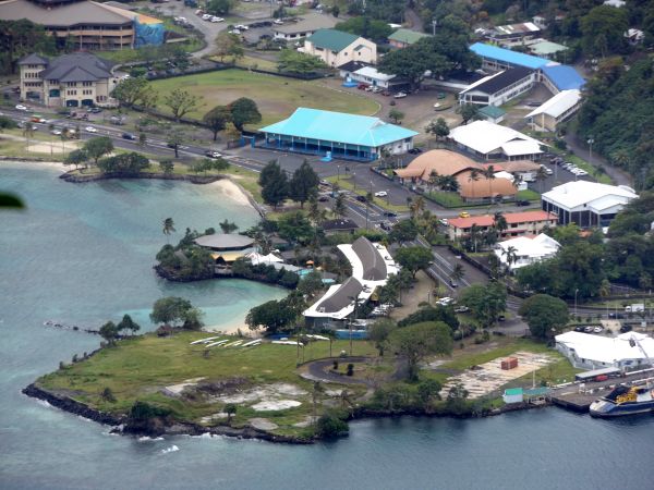
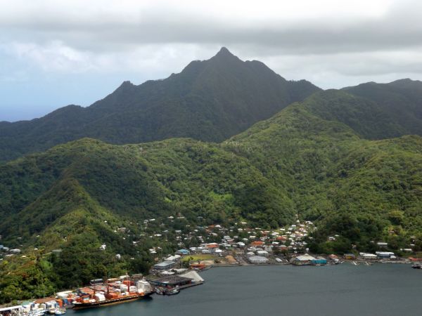
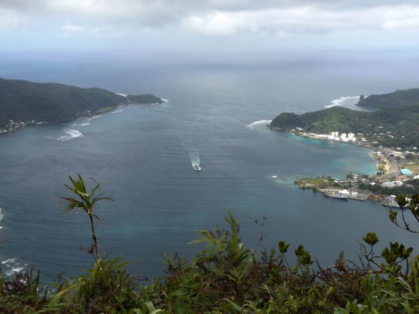
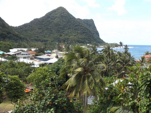
There was a clear view of Vatia village from the lookout point:
A White-tailed tropicbird was circling above the lookout point for several minutes:
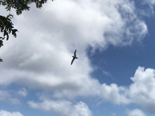
The White-tailed tropicbird then came in for a landing and apparently has a nest in the branches above. Notice the distinctive white tail sticking out from the nest:
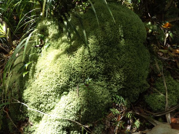
At some areas of the trail, moss seemed to be covering everything in sight:
Greenery and brush once again took over on a large colorful scale:
If I remember correct, this was the spot where I finally reached the mountain top ridge (Maugaloa Ridge) and the trail turned sharply to the west:
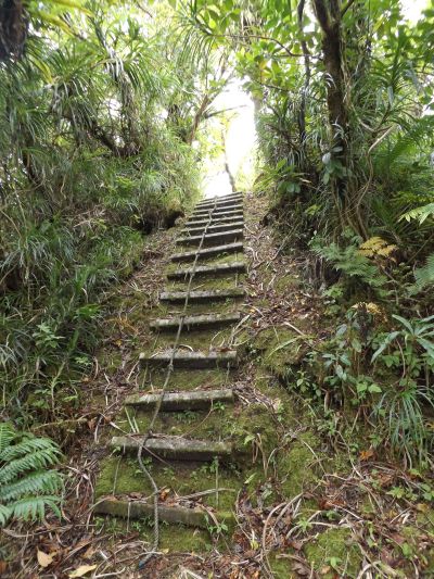
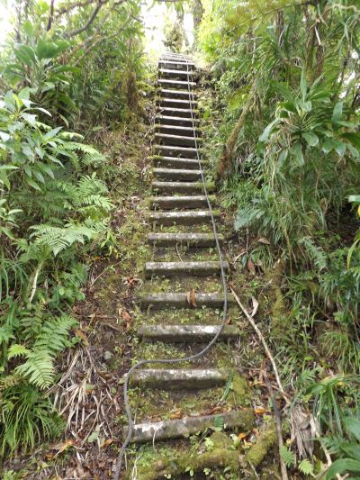
The Maugaloa Ridge has extensive ladders to climb as there are lots of ups and downs:
In the left center of this picture, the road crossing over Afono Pass is visible. Earlier, I had driven over this pass to reach the trailhead:
The sheer cliffs of Rainmaker Mountain were also visible through the branches and leaves:

One nice thing about finally walking along the mountain top ridge was having occasional flat sections of trail:
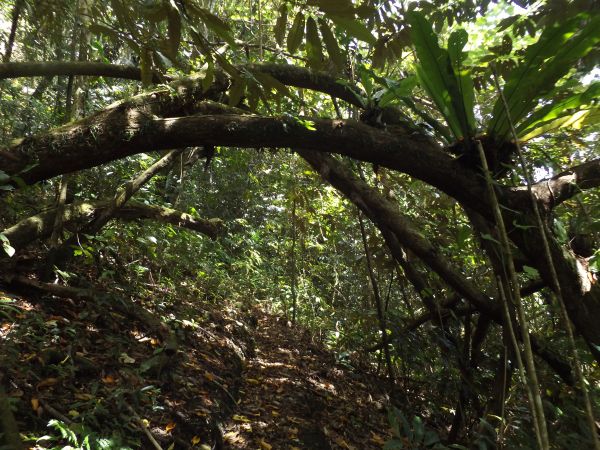
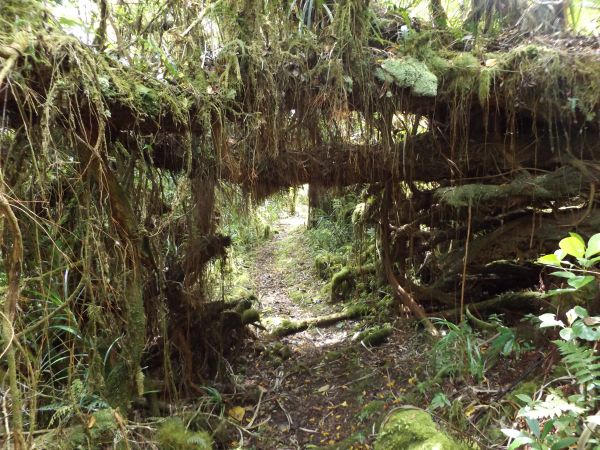
A fallen tree has created a natural bridge to walk under:
As a steep downhill ladder descent begins, the summit of Mount Alava is visible at the top center (left bump):
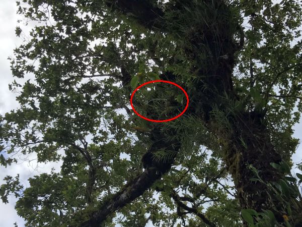
Looking up, I spotted a very pretty and colorful Cardinal honeyeater (Cardinal myzomela) bird:
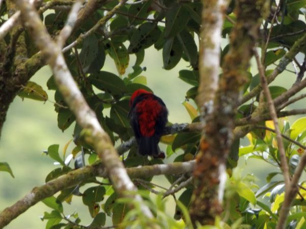
Male Cardinal honeyeaters are bright scarlet red and black in color:
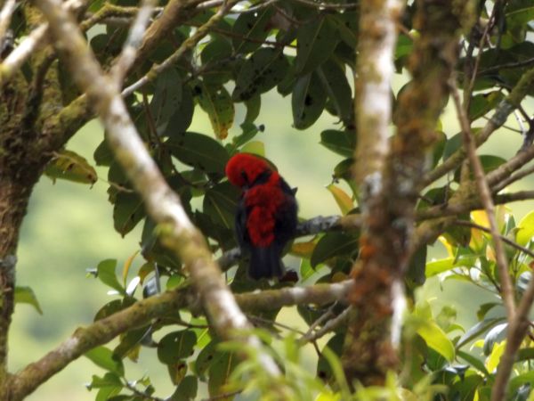
Cardinal honeyeaters have a long curved bill which helps them feed on flower nectar. They have been featured on stamps for Samoa, Vanuatu, Micronesia, Fiji, Palau, the Solomon Islands, and other South Pacific islands:

It was really an outstanding day for hiking with good weather. Enough cloud cover to limit the intense sun but no rain:

If it has been raining recently, you can see how challenging it would be to descend ladders such as these. Slippery conditions and mud would make the trail unsafe:
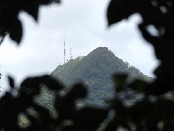
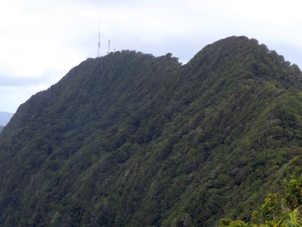
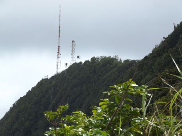
My first clear view of the final summit. The Mount Alava summit can be spotted from far away due to the communications towers:
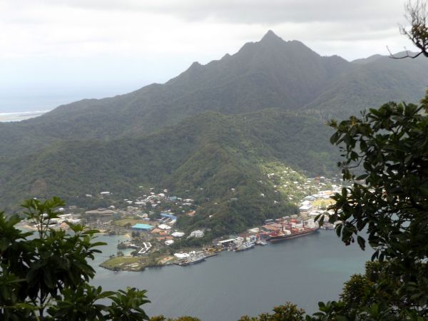
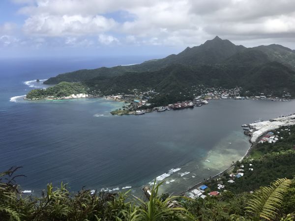
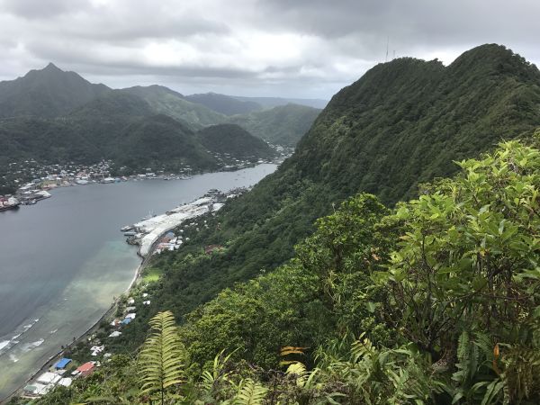
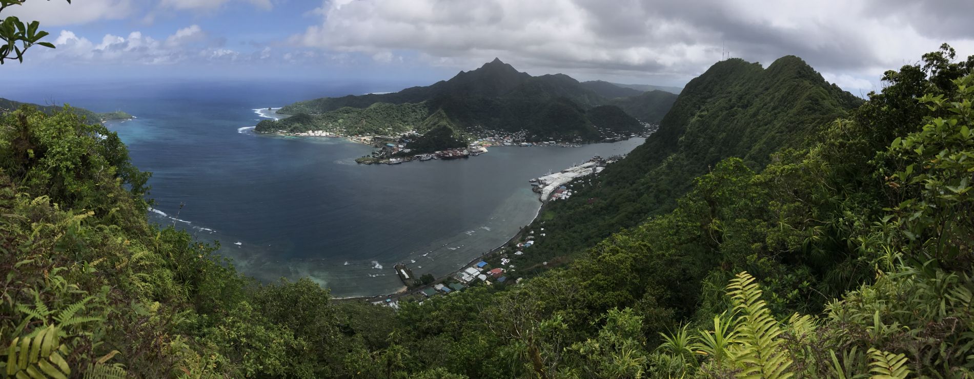
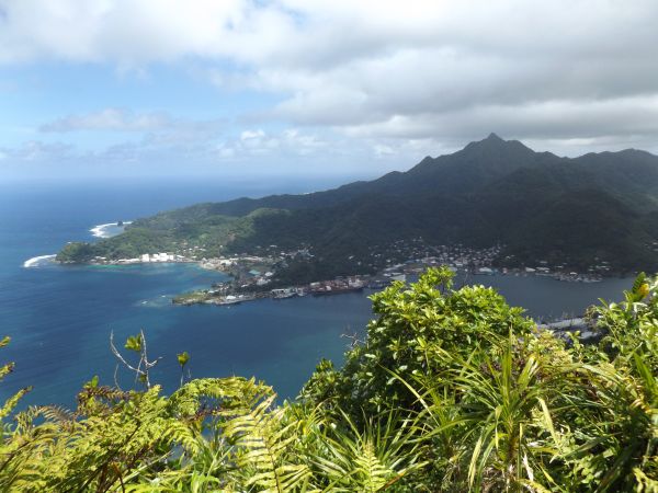
I soon came across a great wide-open viewpoint where Pago Pago harbor and the surrounding villages were all visible:
I had another unique view looking down at Sadie's by the Sea, the lodging place we stayed at in Pago Pago:
Far in the distance to the south, I could actually see the landing strip for the international airport:
Unlike on my previous hike of the regular Mount Alava Trail, Matafao Peak was now fully visible to the southwest:
The stunning summit of Matafao Peak (2,142 feet), the highest point on the main island of Tutuila:
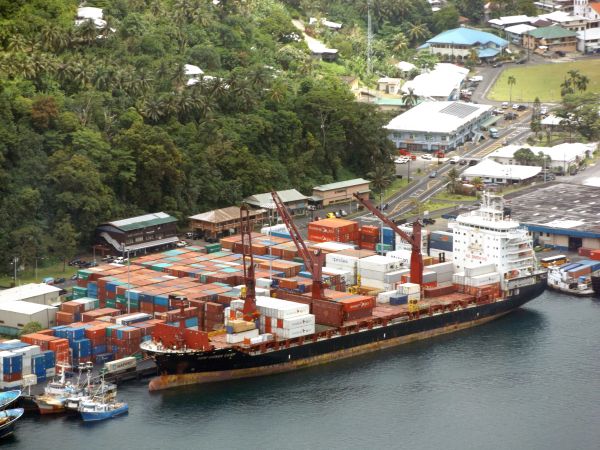
Using my powerful zoom to check out a cargo ship unloading shipping containers:
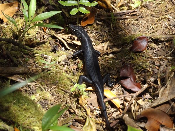
A skink (likely Pacific black skink) that ran across the trail in front of me:
After continuing along a short section of trail, I soon reached another nice viewpoint:
This view was even more sweeping, with all of Pago Pago harbor visible:
This was the incredible view to the west, showing how the cliffs of Mount Alava drop all the way down to the waterfront:
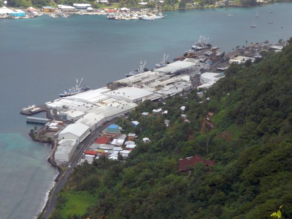
Zooming in on the tuna processing plant owned by StarKist Samoa Co.:
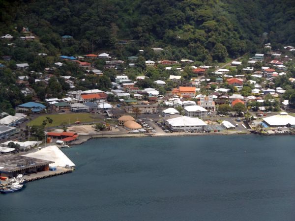
Zooming in on what you might call the city center of Pago Pago. This is the Fagatogo area which has the Senate Fono building, a museum, police station, several banks, and several markets:
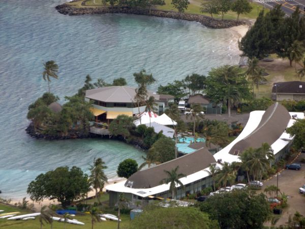
Looking back one more time at Sadie's by the Sea. We stayed in the building in the foreground. The restaurant is located in the octagon building at the back left:
The ridge in the front is Matautu Ridge which contains Blunts Point:
Zooming in on Fatu Rock, otherwise known as Flowerpot Rock. This ocean landmark is so famous in American Samoa that it appears on license plates:
From this slightly alternate angle, I wanted to get a couple more pictures of Matafao Peak and the surrounding mountains:
Some extremely steep slopes drop down from the summit of Matafao Peak:
Looking toward the summit of Mount Alava, it looked like I still had some more elevation to gain:
Panoramic view of Pago Pago Harbor as seen from the Maugaloa Ridge (click to enlarge):
A sharp bend in the trail as I departed from the viewpoint:

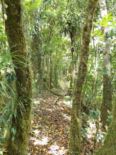
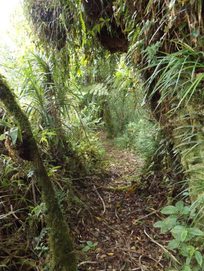
A very narrow trail passes between trees and thick brush on each side:

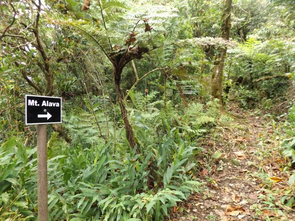
Reaching a major junction on the trail. Turning right here leads down to Vatia, while turning left (visible portion of trail) leads to the Mount Alava summit:
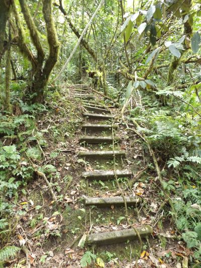
Just after the junction, the trail becomes extremely steep and you have to climb the toughest series of ladders found on the hike:
One ladder after another is in place to help you climb the steep terrain:
Most of the time, there are ropes or cables to hold onto while climbing up the steps of the ladders:
To the east, Rainmaker Mountain became visible. The lower summit on the right is the high point of the Papatele Ridge (1,069 feet):
Rainmaker Mountain contains two major peaks -- North Pioa Mountain (left peak 1,718 feet) and South Pioa Mountain (right peak 1,619 feet):
The large village of Aua can be seen at the base of the mountain. Breakers Point is at the far tip of the peninsula extension:
The trail continues heading for the summit while remaining fairly open on the left side:
The communications towers on the summit look closer than ever:
The far left tip visible contains Blunts Point. Two trails start from near this location -- the Blunts Point Trail and the World War II Heritage Trail. The Heritage Trail heads right and circles around above the village and bay visible. It ends near the bottom of the tramway station which used to connect with the summit of Mount Alava:
Getting one final zoomed picture of Flowerpot Rock:
There are both climbs and descents on the way to the summit along the top ridgeline. This results in cumulative elevation gain in both directions:
There are some very pretty sections of trail along the way. So much greenery along with trees growing tall:
The summit continues to tease hikers while approaching it, but there are more ladders to use:
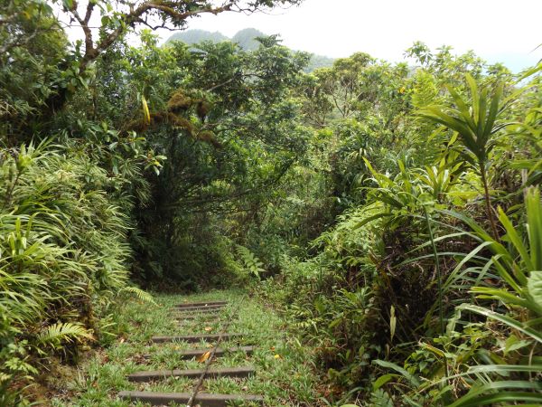
A natural tunnel made of brush to pass through:
Looking to the north, Pola Island was slightly visible (distant right) along with the separated portion containing Cockscomb Point (distant left):
There was now a complete view of Pago Pago Harbor, where there are always boats coming and going:
Just prior to reaching the summit, the final ladder climb takes place:
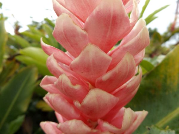
A beautiful display of Red (or pink) ginger was growing at the summit:
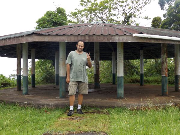
I didn't take many pictures from the Mount Alava summit, because I already took those and included them on my regular Mount Alava Trail report. Here I am standing in front of the Samoan Fale at the summit and showing a "2" since this was my second time on the summit:
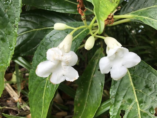
These pretty white flowers were in bloom along the trail:
Returning to the trail junction I was at before. Earlier, I had come down from the trail seen straight ahead. Now I had to turn left (out of view) and head down toward Vatia village:
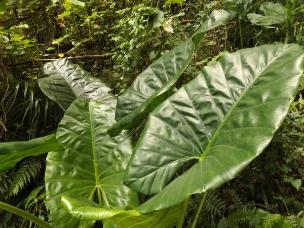
Surprisingly, this portion of the trail does not head straight down and begin descending rapidly. Rather, it stays relatively level for a while:
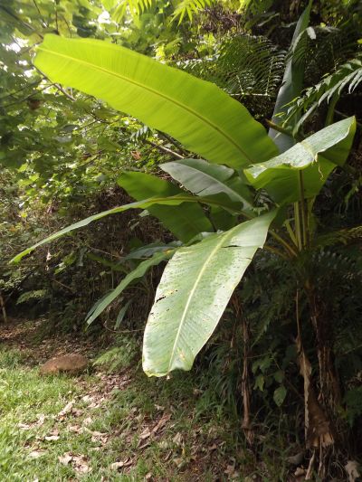
As the next two pictures show, some plants with giant leaves are passed by. Most people can likely identify both of these without me giving it away:
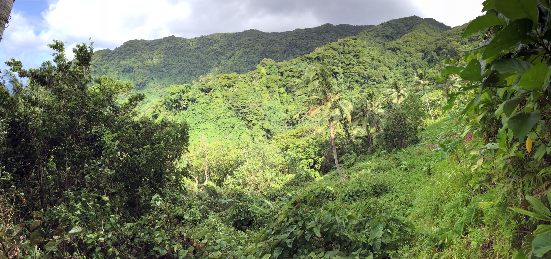
The mountainside is absolutely blanketed with green from all the plants, ferns, trees, and grasses:
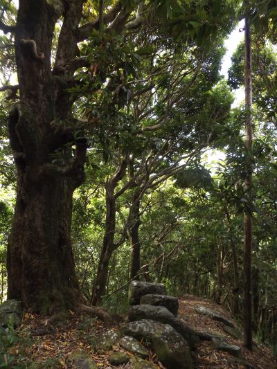
After heading downhill for a while, the trail reaches this large tree with some peculiarly placed stones:
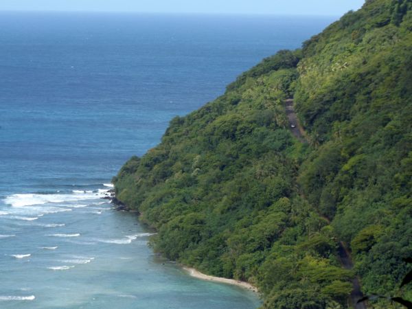
I could soon see the coastal road climbing out of Vatia village. I was dreading the portion of the hike along the hot asphalt pictured here, which would have been necessary to get back to my car, had I not caught a bus in town:
Panoramic looking east toward the Tiatauala Ridge connecting with the Sauma Ridge (click to enlarge):
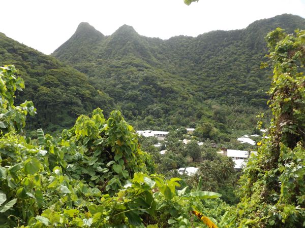
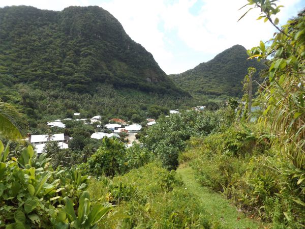
The outskirts of Vatia village came into view along with Mauagotula Peak (upper left):
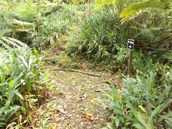
Notice how a path has been cut through the grass to mark the trail:
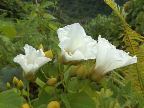
Some very large white flowers along the trail just above Vatia:
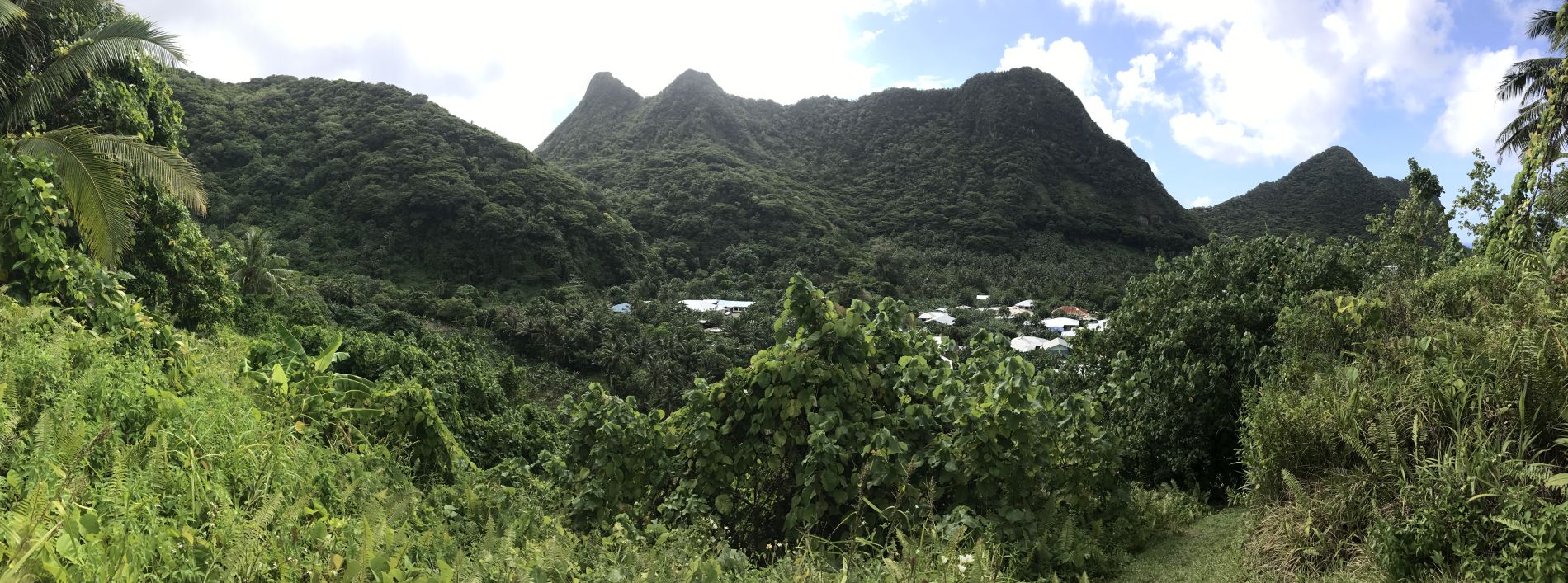
Panoramic showcasing the great height of the Siuono Ridge high above Vatia village (click to enlarge):
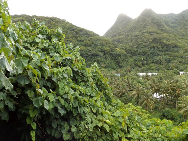
Such a pretty spot with a huge wall of green plants next to the trail and a large group of coconut trees down below:
Arriving in Vatia village after a challenging hike of almost 5 hours. It was now time to avoid the vicious dogs:
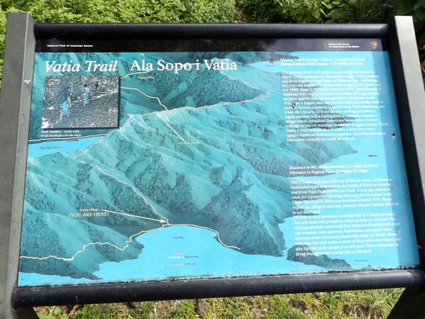
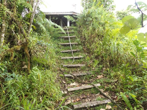
At the end of the trail, there is an informational sign which shows part of the route and discusses the trail history: