

The Zion Narrows is not really a hike that needs any kind of introduction from me. It is well known as one of the best hikes in the world and is sitting near the top of many "best of" lists. For instance, National Geographic placed it at #5 on their list of the 100 Best Adventures in the United States (and it was the top hike, the 4 adventures listed above it included rafting, mountain biking, dog sledding, and kayaking destinations). Many web sites list the Zion Narrows and nearby Paria Canyon as the two best canyon hikes in the world. Backpacker Magazine lists it as one of their Best Hikes Ever. Those are just a few of the honors it has earned. After successfully hiking the Zion Narrows in the summer of 2011, I will be adding it to one of my personal lists as one of the best and most beautiful hikes of my life. For those unfamiliar with this legendary hike, here are a few basic details about it.
The Zion Narrows is a 16 mile one-way hike down the North Fork of the Virgin River in Zion National Park which usually takes a minimum of 12 hours for the fastest hiker to complete. A majority of the hike is spent walking through rushing water, crossing the river from one side to the other, or walking across rough riverbank rocks which are very uncomfortable. It is considered a dangerous hike because of the flash flood potential. Since much of the hike is spent walking through high towering narrows, rain taking place many miles away has the potential to create a flash flood and turn the river into a torrent which would sweep hikers away who are trapped between the walls. So monitoring the weather forecast the day before and of your hike is vital for safety purposes. It is also vital to secure a permit long in advance to take the hike, as there are a limited number of spots available each day. The hike gains its well deserved fame due to the seemingly never ending beautiful towering narrows which you hike through. There really is no other place like this in the entire world and it can be considered a once in a lifetime experience (although I hope to be able to hike it again someday as a 2 day backpack in order to have more time to appreciate the beauty). Before the hike, we rented some necessary gear. We rented canyon shoes designed for handling the water and conditions (5.10 Canyoneers), Neoprene socks, and a walking stick. If it had been colder or the river had been higher, we also would have gotten either a wetsuit or a drysuit and a dry bag. But since the river had dropped well below the hiking limit of 130 CFS, down to around 75 CFS, we figured we would be fine. Especially since it had been super hot outside during our first few days in Zion. We also arranged for a shuttle to drop us off at Chamberlain's Ranch, since it is a one-way hike. For this hike, I was joined by my friend Charlie from Death Valley. We ended up meeting up with a school teacher from Germany named Michael, and the three of us hiked together for the day. In fact, many of the pictures you will see below were taken by Michael, who is an excellent photographer. Everything went well on our hike, which proved to be extremely difficult and exhausting, and I will share more details about specific areas in the pictures down below.
The Zion Narrows is a 16 mile one-way hike down the North Fork of the Virgin River in Zion National Park which usually takes a minimum of 12 hours for the fastest hiker to complete. A majority of the hike is spent walking through rushing water, crossing the river from one side to the other, or walking across rough riverbank rocks which are very uncomfortable. It is considered a dangerous hike because of the flash flood potential. Since much of the hike is spent walking through high towering narrows, rain taking place many miles away has the potential to create a flash flood and turn the river into a torrent which would sweep hikers away who are trapped between the walls. So monitoring the weather forecast the day before and of your hike is vital for safety purposes. It is also vital to secure a permit long in advance to take the hike, as there are a limited number of spots available each day. The hike gains its well deserved fame due to the seemingly never ending beautiful towering narrows which you hike through. There really is no other place like this in the entire world and it can be considered a once in a lifetime experience (although I hope to be able to hike it again someday as a 2 day backpack in order to have more time to appreciate the beauty). Before the hike, we rented some necessary gear. We rented canyon shoes designed for handling the water and conditions (5.10 Canyoneers), Neoprene socks, and a walking stick. If it had been colder or the river had been higher, we also would have gotten either a wetsuit or a drysuit and a dry bag. But since the river had dropped well below the hiking limit of 130 CFS, down to around 75 CFS, we figured we would be fine. Especially since it had been super hot outside during our first few days in Zion. We also arranged for a shuttle to drop us off at Chamberlain's Ranch, since it is a one-way hike. For this hike, I was joined by my friend Charlie from Death Valley. We ended up meeting up with a school teacher from Germany named Michael, and the three of us hiked together for the day. In fact, many of the pictures you will see below were taken by Michael, who is an excellent photographer. Everything went well on our hike, which proved to be extremely difficult and exhausting, and I will share more details about specific areas in the pictures down below.
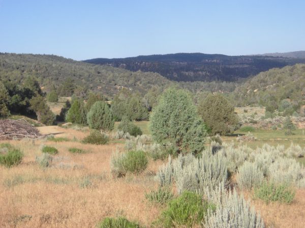


Near the starting point at Chamberlain's Ranch are some long wide open meadows. The walk through this area takes about 2 hours through 4 miles until the scenery gets more interesting:
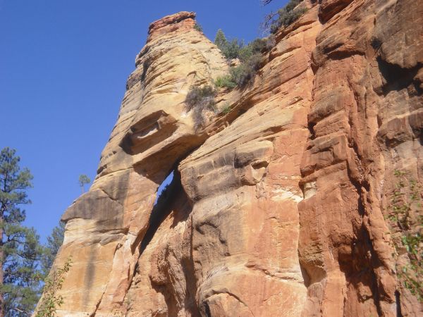
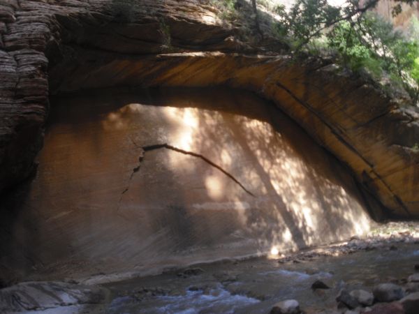
A small arch formation up on the rock as we started through the creek crossing area:
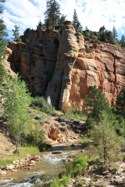
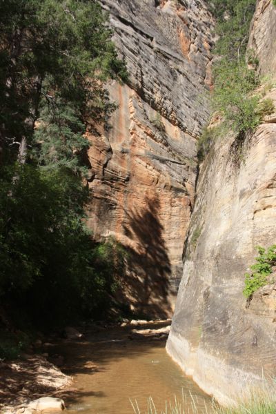
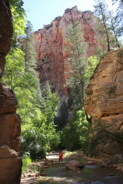
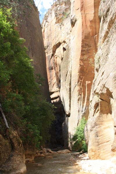
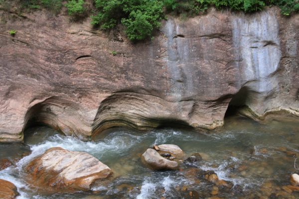
After we left the meadow and dropped into the creek, this was the typical scenery for quite some time:
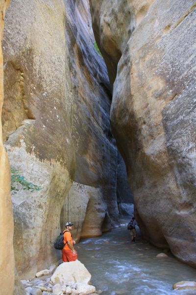
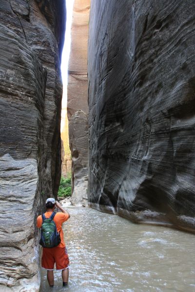
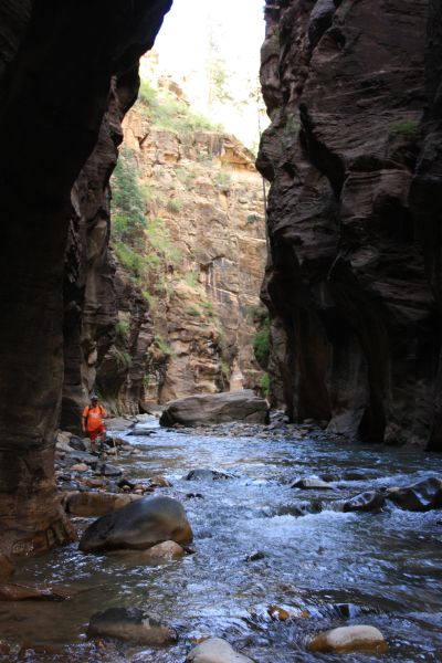
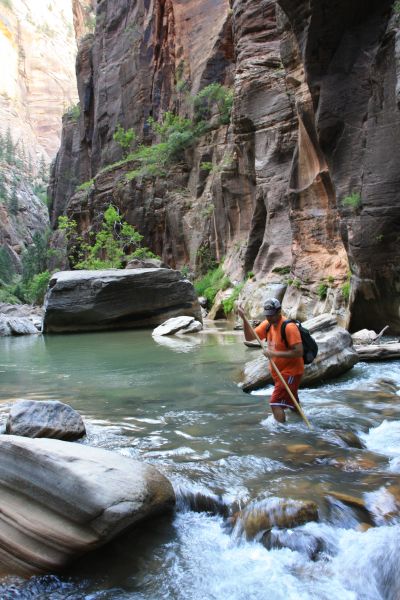
I was wearing bright orange for the hike. In the early part of the creek, usually one or both sides were hillside and we were frequently crossing the creek, staying mostly dry:
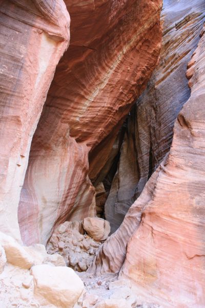
The next two pictures show a pretty slot canyon which is a short side canyon we passed by:
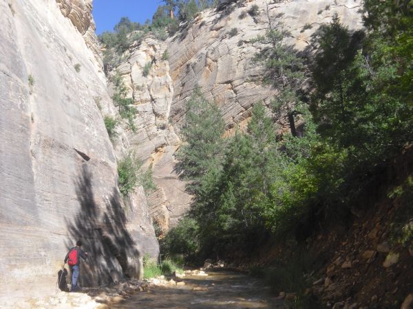
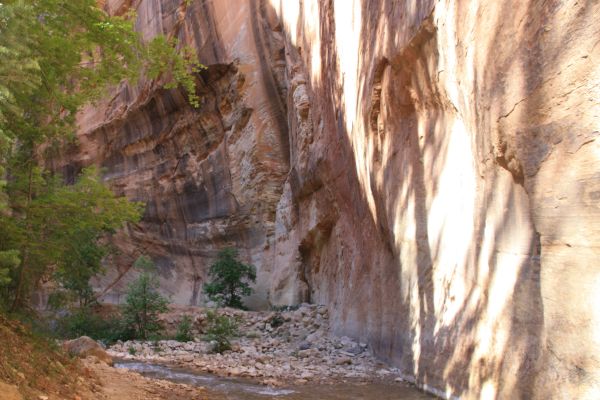
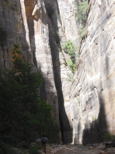
Michael is seen here walking along the side of the creek, as canyon walls began growing:
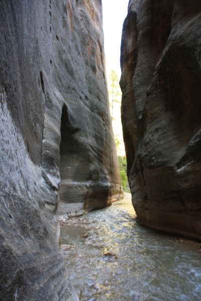
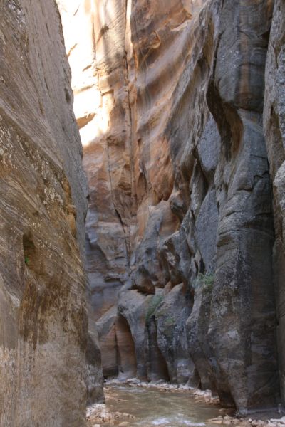
Even at this point, the canyon was quite narrow in some areas and there were a lot of bends:
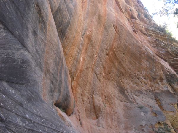
Check out the pretty, colorful rock on the canyon wall seen in the next two pictures:
Most of the time, the hike takes place in the shade. The canyon walls are so high that the sun has a difficult time shining through:
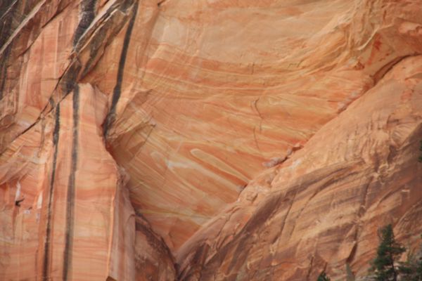
Notice how a variety of colors and patterns paint the walls all the way to the top:
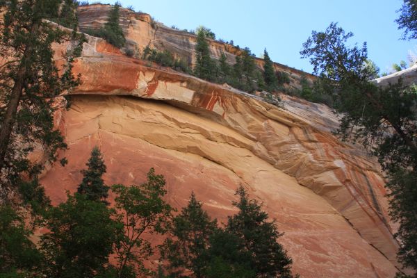
Looking way up at another arch-like formation made up of a mixture of red shades:
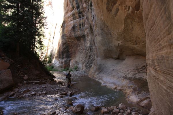
You can see Charlie and I at the bottom of this picture. It should give you an idea of how tall the canyon walls have gotten above the North Fork of the Virgin River:
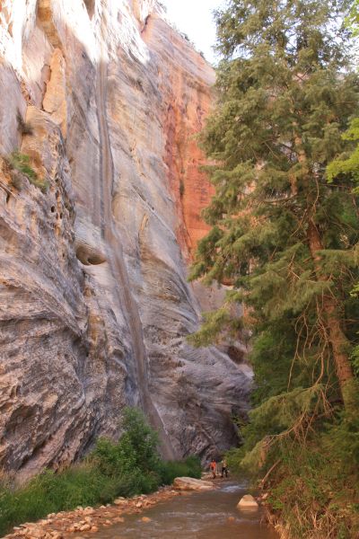
Steve continuing downstream with a tall, pretty waterfall off in the distance:
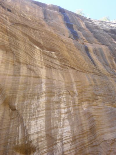
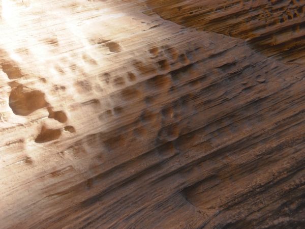
Look at the amazing designs created by wind blasting the sandstone:
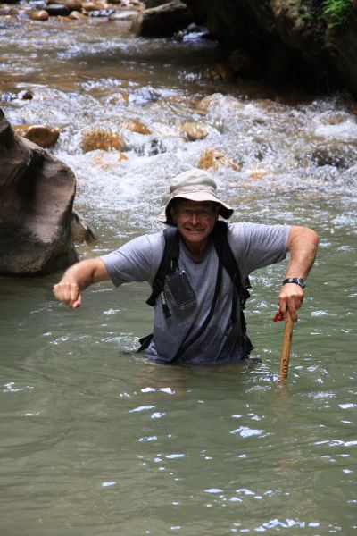
A close-up of Steve as he takes on this great adventure:
The beautiful tall trees add to the amazing atmosphere of the canyon:
Passing by a very interesting section where the canyon wall has an indentation:
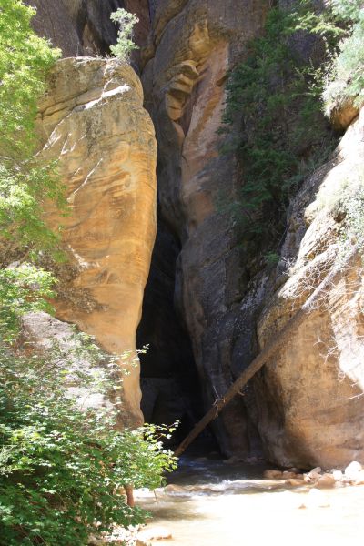
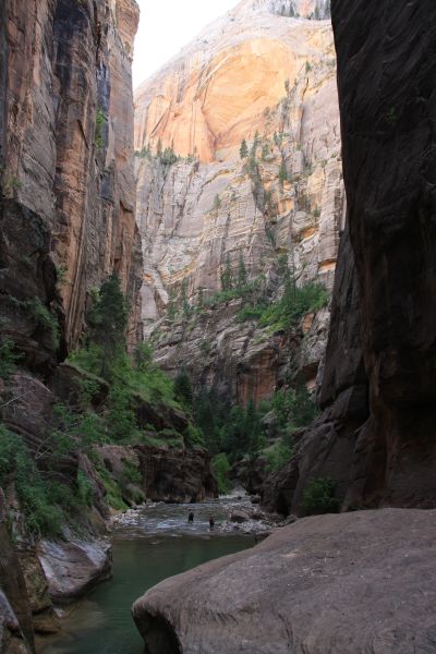
Can you see where we are walking into up ahead? This is the beginning of the Upper Narrows:
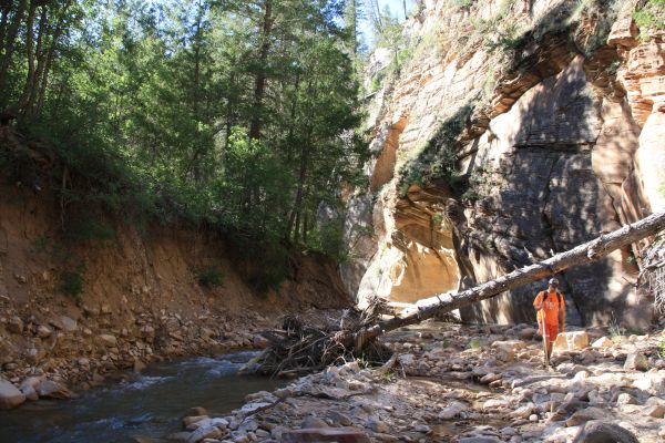
A fallen tree rests precariously on the canyon wall as we head into the first set of narrows:
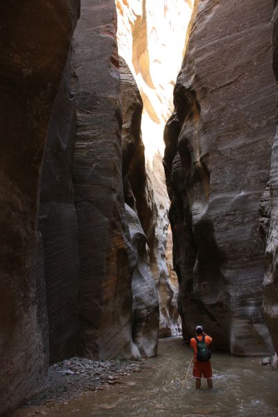
Steve wonderstruck over the incredible narrows as he looks up in awe:
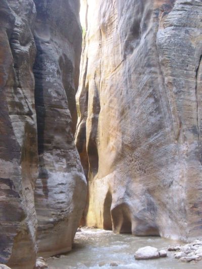
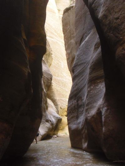
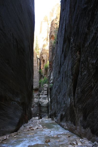
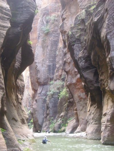
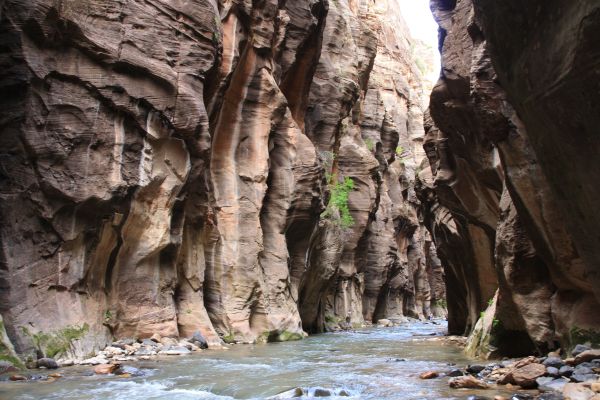
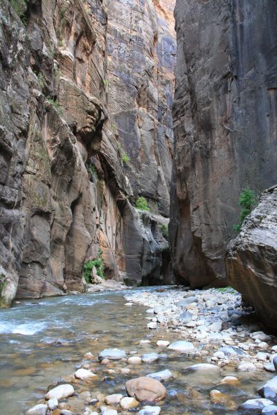
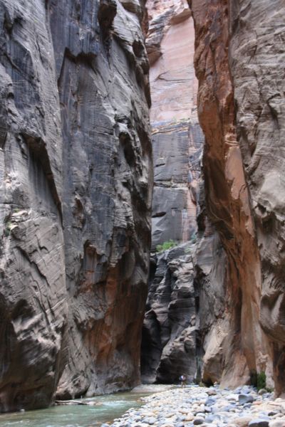
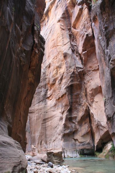
The Upper Narrows were my introduction into lengthy and massive canyon narrows, on a scale I had never before seen in my hikes in Death Valley:
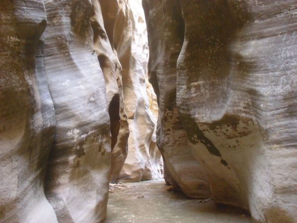
And these were wet narrows, as the river took up all the walking space in between the canyon walls:
It's easy to see why a flash flood blasting through here would result in a quick drowning death. There is nowhere to go:
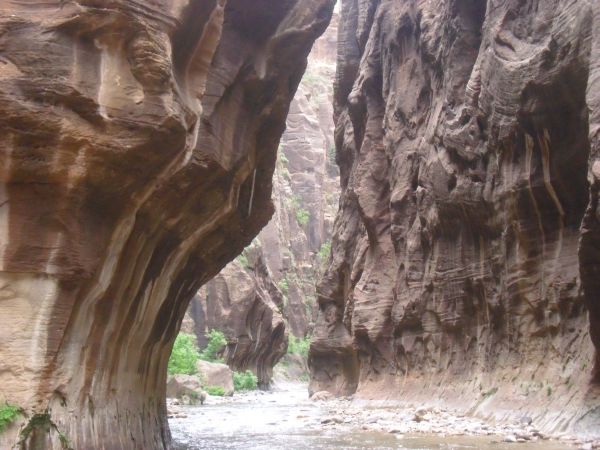
Briefly coming out into an open area of the canyon, but not for long:
Perhaps a bit reminiscent of the colors found in the narrows of Fall Canyon in Death Valley. But again, the scale is no comparison. These narrows are massive:
Stopping in the middle of the river for a picture of the upcoming section of narrows:
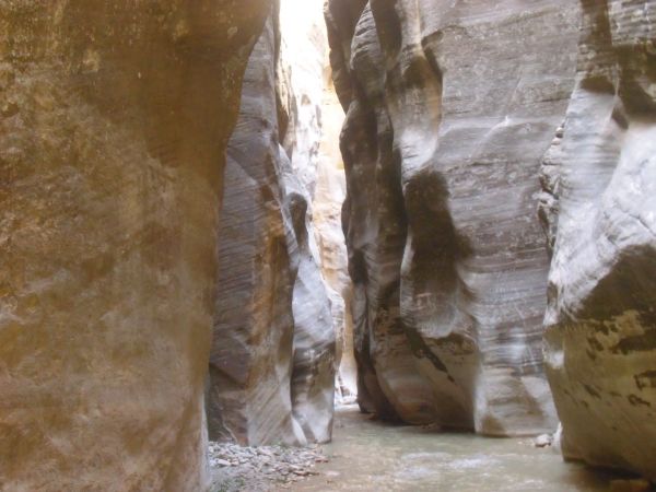
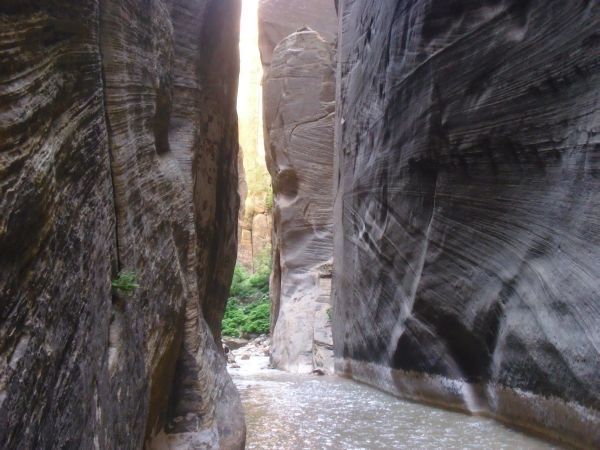
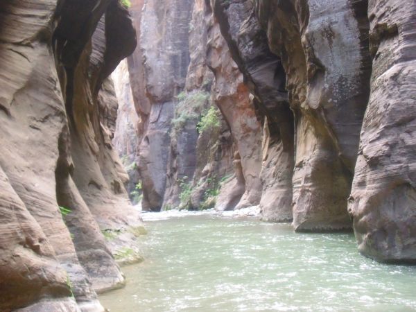
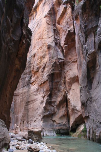
This is actually the picture I took at that moment. Very pretty walls and narrows:
I love the contrast in here between light and dark, between the golden glow of the sun on the far walls and the black darkness on the closer walls:
It's just such an amazing experience to walk through the Upper Narrows. I feel incredibly privileged to have walked through this area:
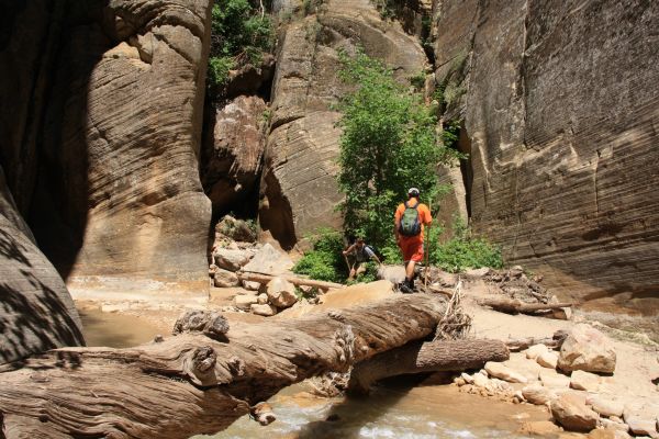
Crossing a log in between sections of tight narrows:
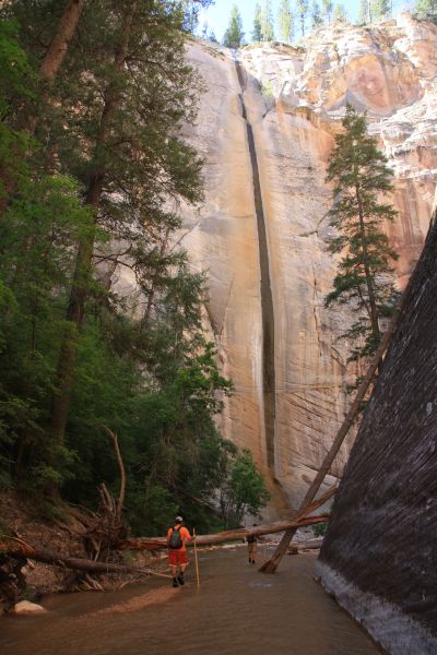
Eventually we came upon the edge of a 12 foot waterfall and had to take this bypass to the left:
A look back at the very pretty 12 foot North Fork Falls that we bypassed:
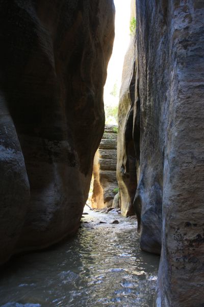
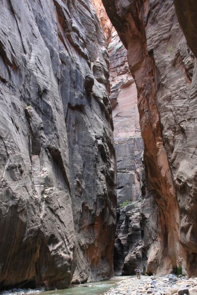
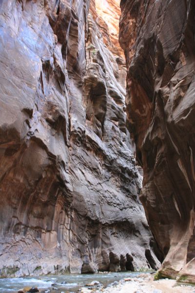
More narrows up ahead as the walls continued to increase in height:
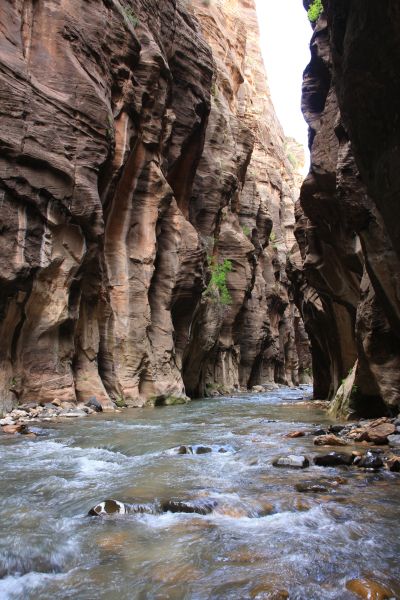
A positively beautiful, long narrow passage we walked through:
Another picture of Steve as he stops to take one of his endless photographs. For this report, I only used about 1/4 of the pictures from the day:
The view as seen through my camera from that spot:
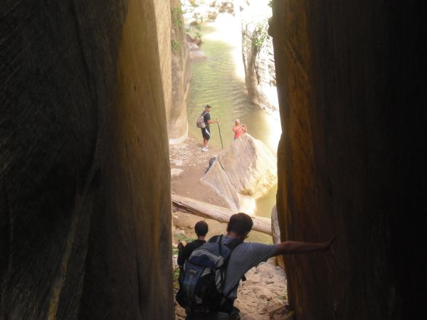
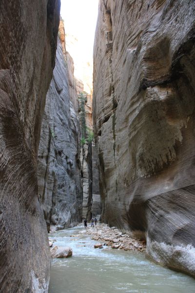
Another group up ahead. Most of the time in the upper canyon we were hiking alone, but at times we would pass other groups or they would pass us:
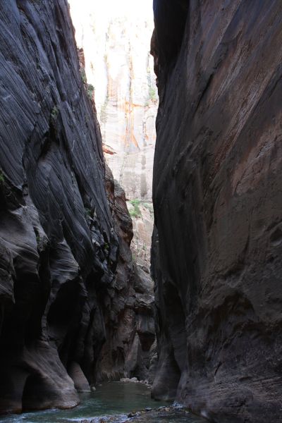
Heading into the darkness of some more deep slot narrows:
Basically, the beauty never ends through here. At the same time, the hike is incredibly hard and slow because you are dealing with water and rocks that are uncomfortable to walk on:
Three more pictures passing through this impressive section of canyon. Definitely breathtaking:
Steve emerging from the Upper Narrows to survey the scene ahead:
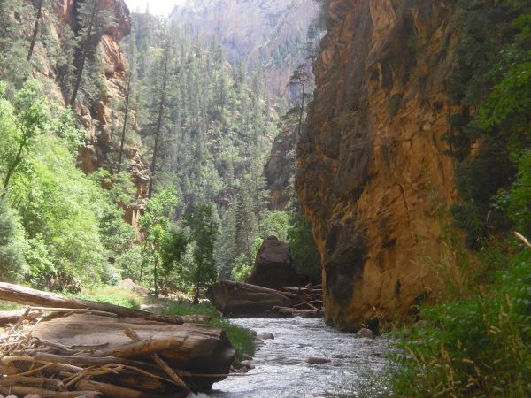
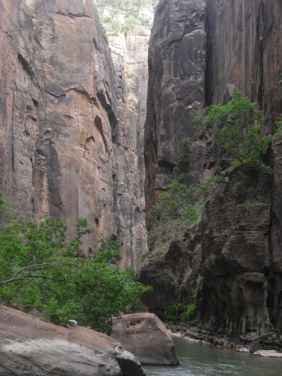
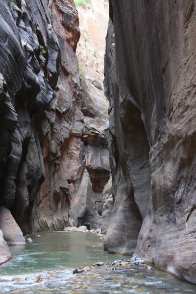
A bit more open through this part, but another kind of beauty with the interesting rock designs and formations:
A pretty spot in the middle canyon where the forest meets the North Fork of the Virgin River:
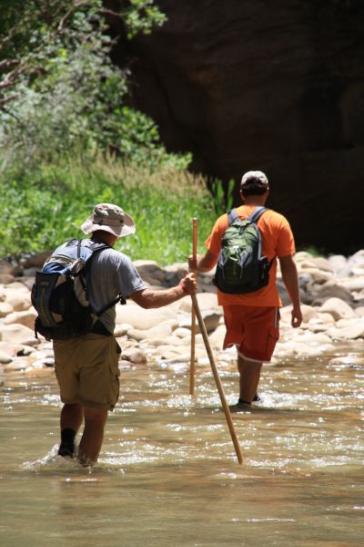
Close-ups of Steve and Charlie as they hiked ahead splashing through the river:
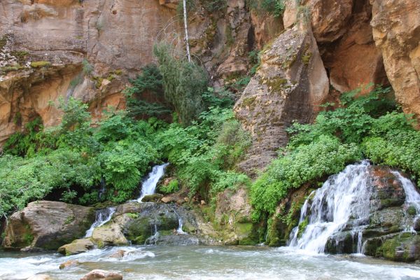
Here we have reached Big Springs. We stopped here to pump fresh drinking water and take some pictures. This is also the spot where dayhikers without permits are allowed to hike up to, so we ran into large groups of people. This spot is 11 miles and 8 hours into the hike:
Another shot of the cascade pouring down from the side canyon:
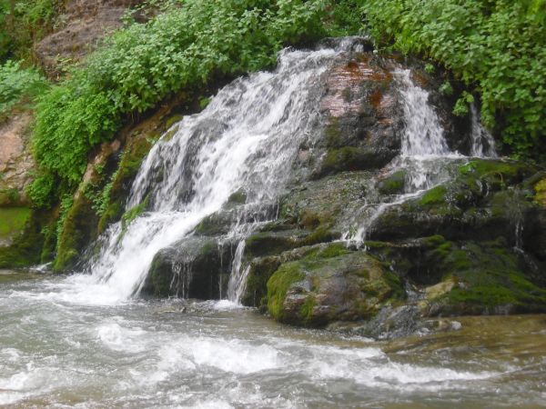
Dayhikers without permits miss all of the scenery you have seen up to this point. But they still have access to some amazing narrows, as you can see:
Charlie continuing down canyon as we head into the Lower Narrows:
Steve coming around a bend in the canyon. Hard to believe we've already been hiking through this water for about 8 hours now:
Up ahead the water gets a bit deeper. Charlie is struggling to stay dry. Many times, a hiker would have to swim through these sections in order to progress further:
You can see that the water is quite a bit deeper, as there are no banks and the walls are close together:
Even with all of the extra hikers around in the middle of summer, we still found spots in the narrows where we had the canyon to ourselves:
A wider view of the same spot from above showing more of the canyon walls:
The canyon wall leans out over the river:
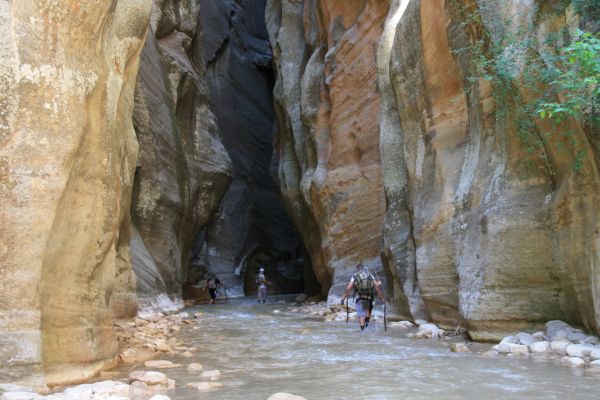
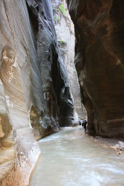
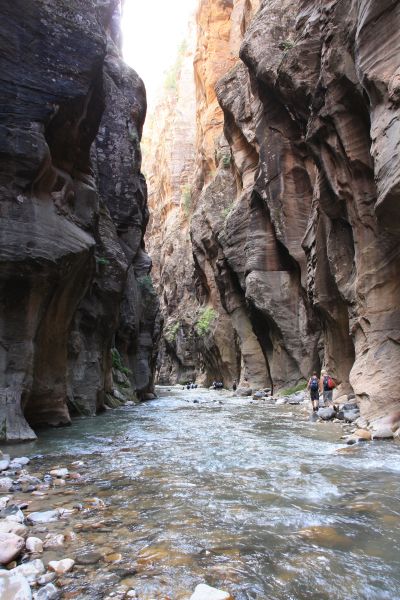
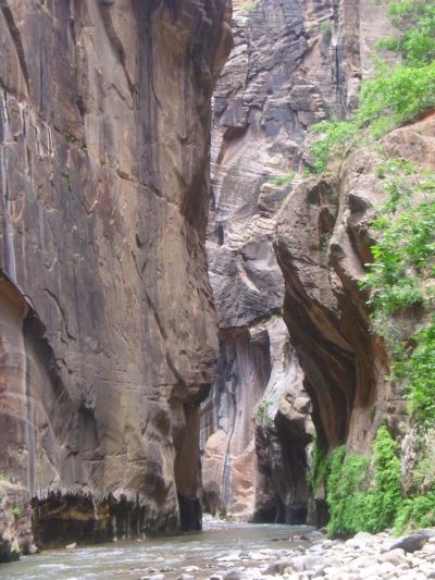
Heading into the final stretch of narrows. This section is known as Wall Street:
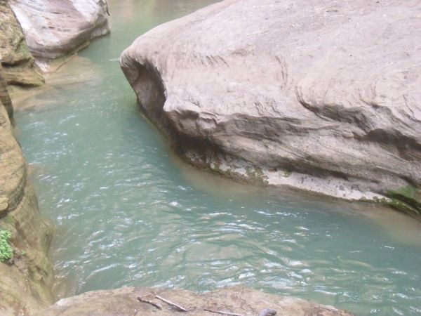
A deep pool with possibly no way through except for swimming:
Charlie struggling to stay dry as he tiptoes through a deep part:
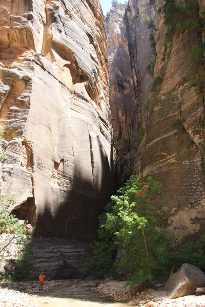
The towering walls of the Wall Street narrows:
Wall Street is the most famous section of the Zion Narrows and it also happens to be the most accessible part of the canyon to the general public. Wall Street starts only 2 hours and 2 1/2 miles from the bottom of the trail for a dayhiker with no permit:
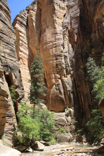
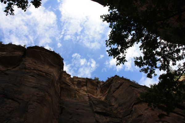
Looking up out of Wall Street at the blue sky high above the two sides of the canyon:
Looking down on a pretty section of the river as we were up on a bypass bank:
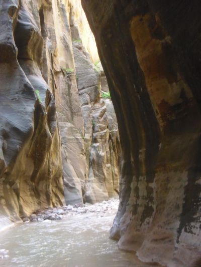
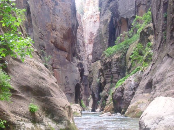
Gorgeous sandstone on the canyon walls above the river:
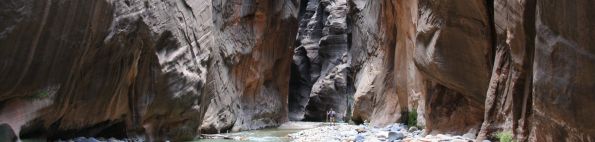
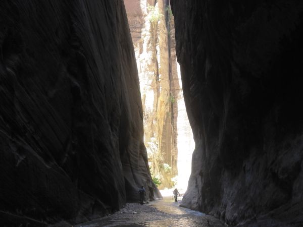
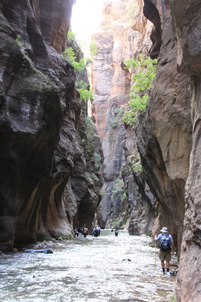
People hiking through the Wall Street section look like ants in comparison to the grand scale of this place:
We were about 9 hours into our hike at this point as we headed into the best narrows of Wall Street:
Steve fording the river just above a small set of rapids:
The next 8 pictures take you through the most spectacular of the Wall Street narrows in the lower canyon. Enjoy the scenery:
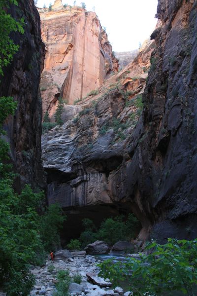
Finally emerging from the last of the great narrows. This is 10 hours into the hike and 13 1/2 miles. Still another 2 1/2 miles to go:
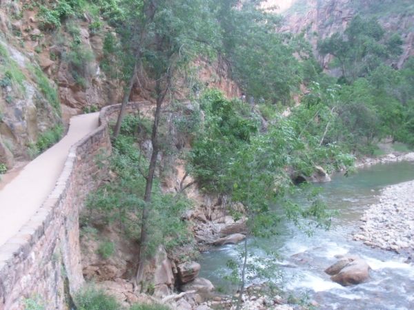
The final mile to the Temple of Sinawava has a nice concrete path to walk on: